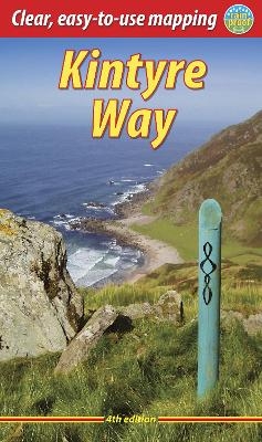
Kintyre Way (4 ed)
Seiten
2018
|
3rd Revised edition
Rucksack Readers (Verlag)
978-1-898481-81-2 (ISBN)
Rucksack Readers (Verlag)
978-1-898481-81-2 (ISBN)
- Titel ist leider vergriffen;
keine Neuauflage - Artikel merken
This fully waymarked trail runs for 101 miles southward from the natural harbour of Tarbert to Macrihanish via Campbeltown. Since it opened the route has evolved. The 2023 edition of this essential guidebook contains all you need: updated mapping of the whole route and detailed directions, with distances, terrain and refreshment stops.
This fully waymarked trail runs for 101 miles/162 km southward from the beautiful natural harbour of Tarbert to Macrihanish, near the Mull of Kintyre. Criss-crossing the entire peninsula, you pass castles, abbeys and prehistoric remains, sometimes walking along rugged coastline, sometimes high on forestry tracks with glorious views over Arran, the Firth of Clyde and towards Ireland. You will enjoy many wildlife sightings in this peaceful area, famous as Scotland only "mainland island". Since it opened (2006) the route has changed in places. The 2023 edition of this essential guidebook contains all you need to plan and enjoy your holiday: 11 pages with mapping showing the whole route (1:70,000); the Way step-by-step, with summaries of distance, terrain and refreshment stops; habitats and wildlife; whisky-making in Kintyre; side-trip to the island of Gigha; and planning information for travel by car, ferry, bus and plane. The book is printed on rainproof paper throughout, and has over 90 colour photographs.
This fully waymarked trail runs for 101 miles/162 km southward from the beautiful natural harbour of Tarbert to Macrihanish, near the Mull of Kintyre. Criss-crossing the entire peninsula, you pass castles, abbeys and prehistoric remains, sometimes walking along rugged coastline, sometimes high on forestry tracks with glorious views over Arran, the Firth of Clyde and towards Ireland. You will enjoy many wildlife sightings in this peaceful area, famous as Scotland only "mainland island". Since it opened (2006) the route has changed in places. The 2023 edition of this essential guidebook contains all you need to plan and enjoy your holiday: 11 pages with mapping showing the whole route (1:70,000); the Way step-by-step, with summaries of distance, terrain and refreshment stops; habitats and wildlife; whisky-making in Kintyre; side-trip to the island of Gigha; and planning information for travel by car, ferry, bus and plane. The book is printed on rainproof paper throughout, and has over 90 colour photographs.
Sandra Bardwell is a dedicated lifelong walker who began hiking in her birthplace of Melbourne, Australia, where she worked as an archivist and historian. She moved to Scotland in 1989 and lives beside Loch Ness. In recent years she has written guidebooks for Lonely Planet (Italy, Ireland, France, Scotland, Australia, 1998-2007), Rucksack Readers (England, Ireland and Scotland) and Sunflower Books (Croatia and Poland-Slovakia, 2006). Jacquetta Megarry is an enthusiastic walker turned publisher. She devised the Rucksack Reader format to suit the needs of hikers, and has written or co-authored over 25 guidebooks on routes in Scotland, England, Ireland and worldwide for Rucksack Readers.
| Erscheinungsdatum | 15.02.2018 |
|---|---|
| Zusatzinfo | 90 Halftones, color |
| Verlagsort | Dunblane |
| Sprache | englisch |
| Maße | 150 x 220 mm |
| Gewicht | 220 g |
| Themenwelt | Sachbuch/Ratgeber ► Sport |
| Reiseführer ► Europa ► Großbritannien | |
| ISBN-10 | 1-898481-81-4 / 1898481814 |
| ISBN-13 | 978-1-898481-81-2 / 9781898481812 |
| Zustand | Neuware |
| Haben Sie eine Frage zum Produkt? |
Mehr entdecken
aus dem Bereich
aus dem Bereich
Geschichten, Geheimnisse und anderes cooles Zeug
Buch | Softcover (2024)
MAIRDUMONT (Verlag)
17,95 €


