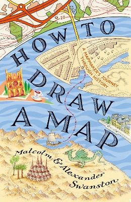
How to Draw a Map
Seiten
2019
Harpercollins (Verlag)
978-0-00-827579-2 (ISBN)
Harpercollins (Verlag)
978-0-00-827579-2 (ISBN)
- Titel ist leider vergriffen;
keine Neuauflage - Artikel merken
How to Draw a Map is a fascinating meditation on the centuries-old art of map-making, from the first astronomical maps to the sophisticated GPS guides of today.
Maps have influenced humanity in many unexpected ways: life, death, sexual reproduction, espionage, war and peace. How to Draw a Map traces the story of mapmaking – cartography – from the first scratchings on the cave wall to the detailed high-tech ‘navigator’. This is the story of human conceptions, often misconceptions, of our world. It is also a very personal story about a mapmaker’s journey through life – the exciting new perspectives and the occasional misadventures.
Over the last 5,000 years societies and empires have risen and fallen; most, if not all, attempt to record their own visions of our world. In the 15th century, Europeans developed a global reach with their oceanic ships, exploring outward into the world, revealing new possibilities, peoples and opportunities. Mapmakers recorded this journey, revealing to us a window into past triumphs and disasters. The story continues into our own day when diplomats carve up our globe, presenting what we now see as the ‘modern’ world.
In How to Draw a Map, father and son cartographers Alexander and Malcolm Swanston demonstrate the skill, creativity and care involved in the timeless art of creating maps – and what these artefacts reveal about the legion of mapmakers who went before us.
Alexander Swanston and Malcolm Swanston have been writing about and mapping history collectively for over 30 years, working on subjects ranging from ancient Rome to Vietnam and beyond. They have researched and written about World War II for many years and have mapped the key battles and events that took place between 1939 and 1945. They have recently produced books on a range of subjects, including The Atlas of the Civil War, The Historical Atlas of the Bible, and The Historical Atlas of Knights and Castles.
| Erscheinungsdatum | 02.09.2019 |
|---|---|
| Zusatzinfo | 60 b/w illus, 20 col plates |
| Verlagsort | London |
| Sprache | englisch |
| Maße | 159 x 240 mm |
| Gewicht | 600 g |
| Themenwelt | Sachbuch/Ratgeber ► Natur / Technik |
| Naturwissenschaften ► Geowissenschaften ► Geografie / Kartografie | |
| ISBN-10 | 0-00-827579-3 / 0008275793 |
| ISBN-13 | 978-0-00-827579-2 / 9780008275792 |
| Zustand | Neuware |
| Haben Sie eine Frage zum Produkt? |
Mehr entdecken
aus dem Bereich
aus dem Bereich
über eine faszinierende Welt zwischen Wasser und Land und warum sie …
Buch | Hardcover (2023)
dtv (Verlag)
24,00 €
Buch | Hardcover (2024)
Schweizerbart'sche, E. (Verlag)
24,00 €
Eine Einführung in die spezielle Mineralogie, Petrologie und …
Buch | Hardcover (2022)
Springer Spektrum (Verlag)
59,99 €


