Exploring Scottish Hill Tracks
Seiten
1991
David & Charles (Verlag)
978-0-7153-9806-7 (ISBN)
David & Charles (Verlag)
978-0-7153-9806-7 (ISBN)
In Scotland there has existed for centuries a complex network of old drove roads, ancient military roads, Pictish roads and stalking paths that cover vast tracts of wild land. This book offers a guide to walkers and mountain bikers interested in exploring these often obscure tracks.
In Scotland there has existed for centuries a complex network of old drove roads, ancient military roads, Pictish roads, coffin roads, whisky roads and stalking paths that cover vast tracts of wild land. Some of these ancient routes are now cart-tracks and some are paths, while others have disappeared from the map altogether and can be traced only by detective work on the ground. Their exploration offers some of the most adventurous cross-country walking in Britain and this book is for all walkers and mountain bikers who wish to explore this precious heritage. There are so many hill tracks in Scotland that in a single volume it would be impossible to describe them all in more than cursory detail. Route selection is inevitable, and the routes selected for this book have been carefully chosen according to a number of criteria. Primarily they are all interesting routes, both scenically and historically. Each forms a worthwhile expedition in its own right, usually of one or two days' duration, but also links to neighbouring routes to form longer expeditions. In addition, shorter circuits are described for those seeking less demanding outings.
The network of routes thus described covers that great tract of mountainous country east of the Great Glen known as the Grampian Mountains, and includes most of the Central Highlands and the Cairngorms. In the route descriptions a track refers to a route that is sufficiently wide and well-constructed to be used by a landrover or a cart, while a path is suitable only for walkers and sometimes bicycles, although the line between the two is sometimes blurred.
The West Highland Way; the Gaick; Comyn's Road; the Minigaig; Glen Tilt; East of Tilt; Glen Geldie and Glen Feshie; around Speyside; the Lairig Ghru; the Laiarig an Laoigh; the Braes of Abernethy; Glen Avon; the Bealach Dearg; Donside and Gairnside; the Thieves' Road; the Corrieyairack Pass; the Great Glen and Glen Spean; across Glen Moriston; Glen Affric.
| Erscheint lt. Verlag | 28.3.1991 |
|---|---|
| Zusatzinfo | 64 b&w line-drawings, 60 half-tones, 60 colour plates, bibliography, index |
| Verlagsort | Newton Abbot |
| Sprache | englisch |
| Themenwelt | Sachbuch/Ratgeber ► Sport ► Motor- / Rad- / Flugsport |
| ISBN-10 | 0-7153-9806-7 / 0715398067 |
| ISBN-13 | 978-0-7153-9806-7 / 9780715398067 |
| Zustand | Neuware |
| Haben Sie eine Frage zum Produkt? |
Mehr entdecken
aus dem Bereich
aus dem Bereich
von Lindau ins Berchtesgadener Land
Buch | Spiralbindung (2024)
Esterbauer (Verlag)
16,90 €
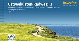
Mecklenburg-Vorpommern : von Lübeck nach Ahlbeck/Usedom
Buch | Spiralbindung (2024)
Esterbauer (Verlag)
16,90 €


