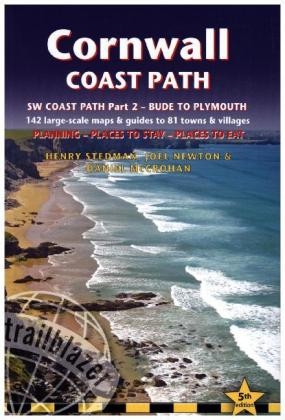
Cornwall Coast Path (Trailblazer British Walking Guide)
Trailblazer Publications (Verlag)
978-1-905864-71-3 (ISBN)
- Titel ist leider vergriffen;
keine Neuauflage - Artikel merken
Practical, complete hiking route guide,with maps and accommodation for the 288-mile footpath that runs around the entire coastline of Cornwall: from Bude to Plymouth. Part 2 of the South-West-Coast Path, a 630-mile national trail from Minehead to Poole. Includes * 142 large-scale maps (3 1/8inches to 1 mile), 24 town plans and 16 overview maps. * Itineraries for all walkers - whether walking the route in its entirety over a week to 10 days or sampling the highlights on day walks and short breaks * Practical information for all budgets - camping, bunkhouses, hostels, B&Bs, pubs and hotels; where to stay, where to eat, what to see. * Comprehensive public transport information - for all access points on the coast path * Flora and fauna - four page full colour flower guide, plus an illustrated section on local wildlife * Green hiking - understanding the local environment and minimizing our impact on it * Includes downloadable gps waypoints. * Plus extra colour sections: 16pp colour introduction and 16pp of colour mapping for stage sections (one stage per page) with trail profiles.
Henry Stedman is a hiker of considerable experience, having hiked in many parts of Europe, Asia and Africa. He has been writing guidebooks for more than a quarter of a century. He is the author and co-author of many guides from Trailblazer: author of Kilimanjaro the trekking guide, Dolomites Trekking, Hadrian's Wall Path, Coast to Coast Path, and co-author with Joel Newton of Exmoor & North Devon Coast Path and Dorset & South Devon Coast Path. Joel Newton is a keen outdoorsman, having completed most of Britain s long-distance paths. He is the co-author of two other British Walking Guides from Trailblazer: Exmoor & North Devon Coast Path and Dorset & South Devon Coast Path and author of Thames Path. Daniel McCrohan is the co-author of numerous guides for Lonely Planet, including India and China. He lived in Beijing for ten years and has trekked many sections of the Great Wall. He has updated several guides for Trailblazer including Pembrokeshire Coast Path, Coast to Coast Path and Hadrian's Wall Path.
INTRODUCTION Cornwall Coast Path History 9 - How difficult is the path? 11 How long do you need? 13 - When to go 14 Festivals and annual events 15 PART 1: PLANNING YOUR WALK Practical information for the walker Route finding 17 - Accommodation 18 - Food and drink 22Information for foreign visitors 26 - Money 26 - Other services 28Walking companies 28 Budgeting 30 Itineraries Which direction? 31 - Village and town facilities 32 Suggested itineraries 37 - Day and weekend walks 39 What to take Keep it light 40 - Rucksack 41 - Footwear 41 - Clothing 41Toiletries 42 - First-aid kit 43 - General items 43Camping gear 43 - Money and documents 44 - Maps 44Sources of further information 44 - Useful books 46Taking dogs along the path 47 Getting to and from the Cornwall Coast Path Getting to Britain 50 - National transport 51Local transport 53 - Public transport map 54 Public transport services 56 PART 2: THE ENVIRONMENT & NATURE Flora and fauna Flora 61 - Conservation schemes: what's an AONB? 63Fauna 65 PART 3: MINIMUM IMPACT WALKING & OUTDOOR SAFETY Minimum impact walking Economic impact 72 - Environmental impact 73 - Access 74 The Countryside Code 76 Health and outdoor safety Avoidance of hazards 77 - Dealing with an accident 78 Weather and weather forecasts 80 PART 4: ROUTE GUIDE AND MAPS Using this guide 81 Bude 83 Bude to Crackington Haven 88 (Upton 88, Widemouth Bay 88, Crackington Haven 94) Crackington Haven to Boscastle 94 Boscastle to Tintagel 99 (Bossiney 101, Tintagel 101)Tintagel to Port Isaac 106 (Trebarwith Strand 106, Port Gaverne 111, Port Isaac 111)Port Isaac to Padstow 113 (Polzeath 117, Rock 119, Padstow 121)Padstow to Trevone 125 Trevone to Treyarnon 129 (Harlyn Bay 129, Mother Ivey's Bay 129, Constantine Bay/Treyarnon 131)Treyarnon to Mawgan Porth 132 Mawgan Porth to Newquay 135 (Watergate Bay 135, Porth 137, Newquay 138) Newquay to Crantock 143 Crantock to Perranporth 146 (Holywell 150, Perranporth 150) Perranporth to Porthtowan 153 (St Agnes 153, Porthtowan 157) Porthtowan to Portreath 158 Portreath to Gwithian 161 Gwithian to Hayle 165 Hayle to St Ives 168 (Lelant & Carbis Bay 170, St Ives 171)St Ives to Zennor Head 177 Zennor Head to Pendeen Watch 180 (Gurnard's Head/Treen 180, Morvah 183, Pendeen & Trewellard 184) Pendeen Watch to Cape Cornwall 187 (Botallack 187, St Just 190) Cape Cornwall to Sennen Cove 191 (Kelynack 192, Sennen & Mayon 193) Sennen Cove to Porthcurno 194 (Land's End 196) Porthcurno to Lamorna 198 (Treen 200, Lamorna 202) Lamorna to Mousehole 203 Mousehole to Penzance 206 (Newlyn 206, Penzance 208)Penzance to Marazion 214 Marazion to Praa Sands 217 Praa Sands to Porthleven 221 Porthleven to Mullion Cove 225 (Halzephron 228, Mullion Cove 228, Mullion 228)Mullion Cove to Lizard Point 231 (Lizard Village 233) Lizard Point to Cadgwith Cove 236 (Cadgwith 236) Cadgwith Cove to Coverack 236 (Kennack Sands 238, Coverack 239)Coverack to Porthallow 241 Porthallow to Helford 244 Helford to Helford Passage 246 (Gweek 247, Nancenoy 250, Helford Passage 250)Helford Passage to Falmouth 97 (Mawnan Smith 254, Maenporth 254, Falmouth 256) Falmouth to Portscatho 261 (St Mawes 262, Portscatho & Gerrans 268)Portscatho to Portloe 268 Portloe to Gorran Haven 273 Gorran Haven to Mevagissey 276 Mevagissey to Charlestown 280 (Pentewan 282, Charlestown 284) Charlestown to Fowey 286 (Par 288, Polkerris 288, Fowey 290)Fowey to Polperro 294 (Polruan 295) Polperro to Looe 302Looe to Portwrinkle 309 (Seaton 312, Downderry 312, Portwrinkle 312)Portwrinkle to Plymouth 314 (Cawsand & Kingsand 318Plymouth 322 APPENDICES Map key 331 Hartland Quay to Bude 332 GPS waypoints 341 INDEX 347 OVERVIEW MAPS & PROFILES 350
| Erscheinungsdatum | 22.04.2016 |
|---|---|
| Reihe/Serie | British Walking Guides |
| Zusatzinfo | 10 black & white illustrations, 10 black & white halftones, 60 colour illustrations, 182 maps, 5 charts, 2 tables, 2 graphs |
| Verlagsort | Hindhead, Surrey |
| Sprache | englisch |
| Maße | 125 x 176 mm |
| Gewicht | 385 g |
| Themenwelt | Sachbuch/Ratgeber ► Sport |
| Reiseführer ► Europa ► Großbritannien | |
| ISBN-10 | 1-905864-71-X / 190586471X |
| ISBN-13 | 978-1-905864-71-3 / 9781905864713 |
| Zustand | Neuware |
| Informationen gemäß Produktsicherheitsverordnung (GPSR) | |
| Haben Sie eine Frage zum Produkt? |
aus dem Bereich


