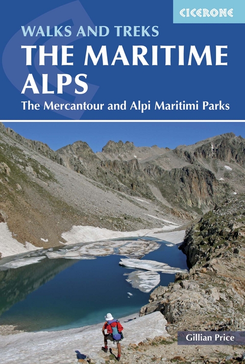
Walks and Treks in the Maritime Alps
Cicerone Press (Verlag)
978-1-85284-845-3 (ISBN)
A guidebook to 18 graded day walks and 6 multi-day treks across the Maritime Alps. Exploring the varied scenery of the border between France and Italy, the day walks are suitable for beginner and experienced walkers alike and treks are suitable for hikers with some alpine trekking experience.
The day walks range from 6 to 20km (4–12 miles) in length and can be enjoyed in 3–7 hours. The multi-day treks vary in length from 22 to 67km (14-42 miles), can be completed in 2–7 days, and include a 5-day traverse of the Parc National du Mercantour and a 7-day traverse of the Parco Naturale delle Alpi Marittime.
Sketch maps included for each walk
Detailed information on accommodation and facilities
Advice on preparation and planning
Easy access from Nice
Gillian Price was born in England but has lived in Venice for many years. Gillian has steadily explored the mountain ranges of Italy, and Corsica, and brought them to life for visitors in a series of outstanding guides for Cicerone. She is an active member of the Italian Alpine Club (CAI) and Mountain Wilderness.
Introduction
The Maritime Alps
Walking
Rock engravings
Plantlife
Wildlife
Exploring the Maritime Alps
Information
Access
When to go
Accommodation
Dos and don'ts
What to take
Maps
Emergencies
Using this guide
The walks
1 Fontanalba Rock Engravings Circuit
2 Mont B&##xe9;go Loop
3 Vall&##xe9;e de la Roya to Vall&##xe9;e de V&##xe9;subie Trek
4 Upper Vall&##xe9;e de la Gordolasque
5 Lacs de Prals Circuit
6 Ancient Passes above Madone de Fenestre
7 Vallon du Haut Bor&##xe9;on Circuit
8 Lacs Bessons
9 Around the Argentera
10 Lac des Adus Loop
11 The Great Lakes Tour
12 The Alpi Marittime Trek
13 The Valasco Tour
14 The Fremamorta Loop
15 Rifugio Bozano
16 Rifugio Remondino and Lago di Nasta
17 Vallone di Lourousa
18 Traversing Colle di Fenestrelle
19 Rifugio Pagari Loop
20 Vallon del Vei del Bouc
21 Gorge della Reina
22 Vallone degli Alberghi
23 Costa di Planard
24 The Border Forts
Appendix 1 French-English and Italian-English glossaries
Appendix 2 Walk summary table
| Erscheinungsdatum | 01.08.2016 |
|---|---|
| Reihe/Serie | Cicerone guidebooks |
| Zusatzinfo | 107 colour photos, 26 maps |
| Verlagsort | Kendal |
| Sprache | englisch |
| Maße | 116 x 172 mm |
| Gewicht | 250 g |
| Themenwelt | Sachbuch/Ratgeber ► Sport |
| Reiseführer ► Europa ► Frankreich | |
| Reiseführer ► Europa ► Italien | |
| Reisen ► Sport- / Aktivreisen ► Europa | |
| ISBN-10 | 1-85284-845-6 / 1852848456 |
| ISBN-13 | 978-1-85284-845-3 / 9781852848453 |
| Zustand | Neuware |
| Haben Sie eine Frage zum Produkt? |
aus dem Bereich


