Cotswold Way
Trailblazer Publications (Verlag)
978-1-905864-70-6 (ISBN)
- Titel ist leider vergriffen;
keine Neuauflage - Artikel merken
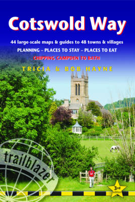
All-in-one hiking route guide and maps to the Cotswold Way, a 102-mile National Trail that runs from Chipping Campden to Bath, following the beautiful Cotswold escarpment for most of its course. The trail leads through quintessentially English countryside with little villages of honey-coloured stone to the well-known town of Bath. Includes 44 large-scale maps (3 1/8 inches to 1 mile); 9 town plans and 8 overview maps. Full details of all accommodations and campsites, restaurants and pubs; plus full public transport information. Plus day-walks. Fully revised and rewalked 3rd edition.
44 large-scale walking maps - at just under 1:20,000 -showing route times, places to stay, points of interest and much more 9 town plans - Chipping Campden, Broadway, Winchcombe, Cheltenham, Painswick, Dursley, Wotton-under-Edge, and the city of Bath 8 area maps and trail profiles Itineraries for all walkers - whether walking the route in its entiretyover seven to eight days or sampling the highlights on day walks and shortbreaks Practical information for all budgets - camping, bunkhouses, hostels,B&Bs, pubs and hotels; Chipping Campden to Bath - where to stay, where toeat, what to see, plus detailed street plans Comprehensive public transport information - for all access points onthe Cotswold Way. Flora and fauna - four page full color flower guide, plus an illustratedsection on local wildlife Green hiking - understanding the local environment and minimizing ourimpact on it Bath city guide Includes downloadable gps waypoints
Tricia and Bob Hayne are hikers of considerable experience, having trekked in many parts of the world. For many years Tricia was editorial director of Bradt Travel Guides.
INTRODUCTION Cotswold WayHistory 8 - Geology 10 - How difficult is the path? 12How long do you need? 13 - When to go 13 PART 1: PLANNING YOUR WALK Practical information for the walkerRoute finding 17 - Accommodation 18 - Food and drink 23Money 24 - Other services 24 - Taking dogs along the path 24Walking companies 25 - Information for foreign visitors 26 Budgeting 28 ItinerariesWhich direction? 30 - Suggested itineraries 30 - Side trips 30Village and town facilities 32 - The best day and weekend walks 36 What to takeKeep it light 37 - How to carry it 37 - Footwear 37Clothes 38 - Toiletries 39 - First-aid kit 39 - General items 39Camping gear 40 - Money 40 - Travel insurance 40 - Maps 40Sources of further information 41 - Recommended reading 42 Getting to and from the Cotswold WayGetting to Britain 43 - National transport 44Public transport map 46 - Local transport 47 PART 2: MINIMUM IMPACT & OUTDOOR SAFETY Minimum-impact walkingEconomic impact 49 - Environmental impact 50 - Access 51 Health and outdoor safetyHealth 53 - Outdoor safety 55 - Weather information 56Walking alone 56 PART 3: THE ENVIRONMENT & NATURE Conserving the CotswoldsGovernment agencies and schemes 58Campaigning and conservation organisations 59Beyond conservation 60 Flora and faunaTrees and shrubs 61 - Wild flowers 62 - Butterflies 65 - Birds 65Mammals 69 - Reptiles 72 PART 4: ROUTE GUIDE AND MAPS Using this guideTrail maps 73 Chipping Campden 74 Chipping Campden to Broadway 80 (Broadway 83) Broadway to Winchcombe 88 (Buckland 88, Snowshill 90,Stanton 90, Stanway 92, Wood Stanway 92, North Farmcote 92,Hailes 94, Winchcombe 97) Winchcombe to Cleeve Hill 100 (Postlip 101, Cleeve Hill 101) Cleeve Hill to Leckhampton Hill 103 (Cheltenham 106, Ham Hill 110, Charlton Kings 110, Upper Coberley 114, Seven Springs 114, Coberley 114, Leckhampton 114) Leckhampton Hill to Birdlip 114 (Little Shurdington 117, Around Crickley Hill 117, Birdlip 117) Birdlip to Painswick 117 (Little Witcombe 119, Cranham Corner 120, Painswick 121) Painswick to Stonehouse/Ebley 126 (Edge 127,Randwick/Westrip 127, Stonehouse/Ebley 130) Stonehouse/Ebley to Pen Wood 130 (King's Stanley 133,Middleyard 133, Selsley 133) Pen Wood to Dursley 134 (Nympsfield 134, Uley 136, Dursley 136) Dursley to Wotton-under-Edge 141 (North Nibley 141,Wotton-under-Edge 144) Wotton-under-Edge to Old Sodbury 149 (Alderley 149,Hillesley 149, Lower Kilcott 149, Hawkesbury Upton 151, Horton 152, Little Sodbury 152, Old Sodbury 156) Old Sodbury to Cold Ashton 156 (Coomb's End 156,Tormarton 156, Pennsylvania 161, Cold Ashton 161) Cold Ashton to Bath 163 Bath 165 APPENDICES GPS waypoints 184Map key 185Distance chart 186 INDEX OVERVIEW MAPS & TRAIL PROFILES
| Erscheinungsdatum | 31.01.2016 |
|---|---|
| Verlagsort | Hindhead, Surrey |
| Sprache | englisch |
| Themenwelt | Sachbuch/Ratgeber ► Sport |
| Reiseführer ► Europa ► Großbritannien | |
| ISBN-10 | 1-905864-70-1 / 1905864701 |
| ISBN-13 | 978-1-905864-70-6 / 9781905864706 |
| Zustand | Neuware |
| Informationen gemäß Produktsicherheitsverordnung (GPSR) | |
| Haben Sie eine Frage zum Produkt? |
aus dem Bereich


