Youghal
Irish Historic Towns Atlas, no. 27
Seiten
2015
Royal Irish Academy
978-1-908996-46-6 (ISBN)
Royal Irish Academy
978-1-908996-46-6 (ISBN)
Youghal is the twenty-seventh in the Irish Historic Towns Atlas Series, which assembles topographical documentations on the development of Irish towns and publishes them as individual fascicles. CD-ROM included.
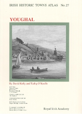
Number 27 in the Irish Historic Towns Atlas series, Youghal traces the growth and development of the town from its origins as an Anglo-Norman borough and seaport, to market town, to seaside resort. Over 25 loose, large-format pages reproduce old maps, plans and views, alongside reconstructions and thematic maps to help tell the story of Youghal in a visual way. An accompanying text section includes an explanatory essay and historical gazetteer with over 1,500 entries on features of the townscape such as streets, schools, town walls, tanneries etc. Also included is a CD-ROM where the text is word searchable and the maps and images are in high resolution allowing for detailed examination. Authors: David Kelly, Tadhg O'Keeffe; Series editors: Anngret Simms, H.B. Clarke, Raymond Gillespie, Jacinta Prunty; Consultant editor: J.H. Andrews; Cartographic editor: Sarah Gearty; Editorial assistants: Angela Murphy, Jennifer Moore
Number 27 in the Irish Historic Towns Atlas series, Youghal traces the growth and development of the town from its origins as an Anglo-Norman borough and seaport, to market town, to seaside resort. Over 25 loose, large-format pages reproduce old maps, plans and views, alongside reconstructions and thematic maps to help tell the story of Youghal in a visual way. An accompanying text section includes an explanatory essay and historical gazetteer with over 1,500 entries on features of the townscape such as streets, schools, town walls, tanneries etc. Also included is a CD-ROM where the text is word searchable and the maps and images are in high resolution allowing for detailed examination. Authors: David Kelly, Tadhg O'Keeffe; Series editors: Anngret Simms, H.B. Clarke, Raymond Gillespie, Jacinta Prunty; Consultant editor: J.H. Andrews; Cartographic editor: Sarah Gearty; Editorial assistants: Angela Murphy, Jennifer Moore
| Erscheint lt. Verlag | 25.5.2015 |
|---|---|
| Reihe/Serie | Irish Historic Towns Atlas |
| Mitarbeit |
Herausgeber (Serie): Professor Anngret Simms, Professor H.B. Clarke, Professor Raymond Gillespie |
| Verlagsort | Dublin |
| Sprache | englisch |
| Maße | 305 x 410 mm |
| Gewicht | 900 g |
| Themenwelt | Sachbuch/Ratgeber ► Geschichte / Politik ► Regional- / Landesgeschichte |
| Geisteswissenschaften ► Geschichte ► Hilfswissenschaften | |
| ISBN-10 | 1-908996-46-3 / 1908996463 |
| ISBN-13 | 978-1-908996-46-6 / 9781908996466 |
| Zustand | Neuware |
| Haben Sie eine Frage zum Produkt? |
Mehr entdecken
aus dem Bereich
aus dem Bereich
