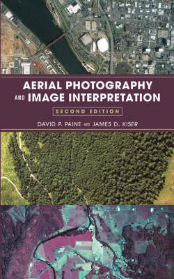
Aerial Photography and Image Interpretation
John Wiley & Sons Inc (Verlag)
978-0-471-20489-3 (ISBN)
- Titel erscheint in neuer Auflage
- Artikel merken
DAVID P. PAINE, PhD, is Professor Emeritus in the Department of Forest Resources at Oregon State University in Corvallis. JAMES D. KISER, MS, is an instructor in the Department of Forest Engineering at Oregon State University in Corvallis.
Preface. 1. Introduction. PART 1: GEOMETRY AND PHOTO MEASUREMENTS. 2. Geometry of a Vertical Aerial Photograph. 3. Principles of Stereoscopic Vision. 4. Scale of a Vertical Aerial Photograph. 5. Horizontal Measurements-Distance, Bearings, and Areas. 6. Vertical Measurements. 7. Acquisition of Aerial Photography. PART 2: MAPPING FROM VERTICAL AERIAL PHOTOGRAPHS. 8. Orthophotography. 9. Map Projections, Grid Networks, and Control. 10. The Global Positioning System. 11. The Transfer of Detail. 12. Geographic Information Systems. PART 3: PHOTO INTERPRETATION. 13. Small-Format Aerial Imagery. 14. Films, Filters, and the Photographic Process. 15. Principles and Techniques of Aerial Image Interpretation. 16. Landforms and Drainage Patterns. 17. Geology, Soils, and Engineering Applications. 18. Land-Use Planning. 19. Environmental Monitoring. 20. Additional Topics in Natural Resources Management. 21. Forestry. PART 4: NATURAL RESOURCES INVENTORY. 22. Elementary Statistics and Sampling Techniques. 23. Mapping Accuracy Assessment. 24. Aerial Photo Mensuration. 25. An Example Photo Timber Cruise. PART 5: AN INTRODUCTION TO REMOTE SENSING. 26. Additional Characteristics of Electromagnetic Energy. 27. Radar and Lidar-Active Remote Sensors. 28. Scanning Remote Sensors. APPENDIXES. A. Summary of Photogrammetric Formulas. B. Summary of Statistical Formulas. C. Specimen Contract for Aerial Photography. D. Selected Aerial Photo Volume Tables. E. Partial Answers to Questions and Problems. F. Partial Answers to Laboratory Exercises. G. Metric Conversion Charts. Index.
| Erscheint lt. Verlag | 16.5.2003 |
|---|---|
| Zusatzinfo | Illustrations (some col.), maps |
| Verlagsort | New York |
| Sprache | englisch |
| Maße | 162 x 236 mm |
| Gewicht | 996 g |
| Einbandart | gebunden |
| Themenwelt | Kunst / Musik / Theater ► Fotokunst |
| Sachbuch/Ratgeber ► Freizeit / Hobby ► Fotografieren / Filmen | |
| Naturwissenschaften ► Geowissenschaften ► Allgemeines / Lexika | |
| Naturwissenschaften ► Geowissenschaften ► Geografie / Kartografie | |
| ISBN-10 | 0-471-20489-7 / 0471204897 |
| ISBN-13 | 978-0-471-20489-3 / 9780471204893 |
| Zustand | Neuware |
| Haben Sie eine Frage zum Produkt? |
aus dem Bereich


