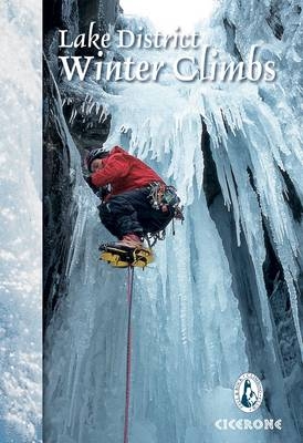
Lake District Winter Climbs
Cicerone Press (Verlag)
978-1-85284-716-6 (ISBN)
Guide to nearly 1000 winter climbs in the English Lake District, ranging from classic high-mountain gullies and buttresses to frozen watercourses and icefalls. Covers all the known venues, with routes at all levels of difficulty from Grade I to Grade VI and above.
Scafell, Pillar, Great Gable, Newland’s Hause, Helvellyn’s eastern coves, and outliers such as Cautley Spout
Photo topos picture the lines taken by climbs, with accompanying text describing the key route features, crux and access/descent notes
Approach maps show the best way to access each crag
Details on climbing with nature conservation in mind, with symbols highlighting routes that are known habitats of rare alpine plants, or within Sites of Special Scientific Interest
Joint production with the Fell and Rock Climbing Club
Comprehensive notes on climbing ethics, including agreed venues for dry tooling
Includes a list of first ascents dating back to the earliest Victorian pioneers
Accommodation listings, climbing walls, safety notes, equipment, and a complete index of routes
The Fell and Rock Climbing club was founded in 1906-07, and membership has since grown to well over 1000 members worldwide who found their mountaineering origins in the Lakes. Its aims are to encourage rock climbing and fell walking in the English Lake District and to act as a bond of union for its members. The club publishes a number of guides to climbing in the area, as well as a bi-annual supplement to new routes.
Acknowledgments
Maps and diagrams in this guide
Location map
Map key
Editor's note
Introduction
Conditions
Winter ethics
Winter climbing styles
Where to climb?
Equipment
Winter grades
Dry tooling grades
Using this guide
First ascents or first claims?
South Lakes
Langdale
Oxendale
Bowfell
Langdale Pikes
Coniston
Dow
The Old Man Of Coniston
Wetherlam
Tilberthwaite and The Slate Quarries
West Lakes
Eskdale
Little Narrow Cove
Wasdale
Scafell Massif
Scafell
Scafell Pike
Lingmell
Mosedale
Western Wasdale
Ennerdale
Mirklin Cove
Mirk Cove and Wind Gap Cove
Pillar
Great Gable and Kirk Fell
Gable South
Gable North
Kirk Fell
Buttermere
Honister Pass
Fleetwith Pike - North Face
Warnscale Bottom
Birkness Combe
Bleaberry Combe
Grasmoor
Newlands
Coledale
Whinlatter
North Lakes
Borrowdale
Borrowdale East
Great End Area
Borrowdale West
Northern Fells
Skiddaw
Blencathra (Saddleback)
Carrock Fell
Thirlmere
East Lakes
Helvellyn Massif
Helvellyn
Nethermost Cove
Ruthwaite Cove
Cock Cove
Dollywaggon
Patterdale and Adjacent Valleys
Patterdale - East
Patterdale - West
Grisedale
Deepdale
Sleet Cove
Dovedale
Kirkstone Pass
Far Eastern Fells
Mardale
Blea Water
Riggindale
Whelter Bottom
Swindale
Longsleddale
Kentmere
Outlying Areas
The Howgills
Northern Pennines
Dry Tooling Routes
First Ascents
Appendix A Winter Climbing and Nature Conservation
Appendix B Procedure for Mountain Accidents
Appendix C Useful Contacts
Appendix D Campsites and Camping Barns
Appendix E Climbing Walls
Index of Routes
| Zusatzinfo | 60 maps, topos and panoramas and 50 colour photos |
|---|---|
| Verlagsort | Kendal |
| Sprache | englisch |
| Maße | 116 x 172 mm |
| Gewicht | 540 g |
| Themenwelt | Sachbuch/Ratgeber ► Sport ► Ski- / Wintersport |
| ISBN-10 | 1-85284-716-6 / 1852847166 |
| ISBN-13 | 978-1-85284-716-6 / 9781852847166 |
| Zustand | Neuware |
| Haben Sie eine Frage zum Produkt? |
aus dem Bereich


