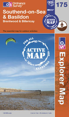
Southend-on-Sea & Basildon
2012
|
A3
Ordnance Survey (Verlag)
978-0-319-46838-8 (ISBN)
Ordnance Survey (Verlag)
978-0-319-46838-8 (ISBN)
- Titel erscheint in neuer Auflage
- Artikel merken
Zu diesem Artikel existiert eine Nachauflage
Suitable for those who enjoy outdoor activities such as walking, horse riding and off-road cycling, this title provides complete GB coverage.
OS Explorer Map is the Ordnance Survey's most detailed map and is recommended for anyone enjoying outdoor activities such as walking, horse riding and off-road cycling. The series provides complete GB coverage and can now be used in all weathers thanks to OS Explorer Map - Active, a tough, versatile version of the OS Explorer Map.
OS Explorer Map is the Ordnance Survey's most detailed map and is recommended for anyone enjoying outdoor activities such as walking, horse riding and off-road cycling. The series provides complete GB coverage and can now be used in all weathers thanks to OS Explorer Map - Active, a tough, versatile version of the OS Explorer Map.
| Erscheint lt. Verlag | 11.6.2012 |
|---|---|
| Reihe/Serie | OS Explorer Map Active ; Sheet 175 |
| Verlagsort | Hants |
| Sprache | englisch |
| Themenwelt | Sachbuch/Ratgeber ► Sport |
| Reisen ► Karten / Stadtpläne / Atlanten ► Europa | |
| ISBN-10 | 0-319-46838-0 / 0319468380 |
| ISBN-13 | 978-0-319-46838-8 / 9780319468388 |
| Zustand | Neuware |
| Informationen gemäß Produktsicherheitsverordnung (GPSR) | |
| Haben Sie eine Frage zum Produkt? |
Mehr entdecken
aus dem Bereich
aus dem Bereich
Straßen- und Freizeitkarte 1:250.000
Karte (gefalzt) (2023)
Freytag-Berndt und ARTARIA (Verlag)
12,90 €
Baskenland, Navarra, Aragon, Andorra, Katalonien
Karte/Kartografie (2023)
MAIRDUMONT (Verlag)
11,95 €
Karte (gefalzt) (2023)
Freytag-Berndt und ARTARIA (Verlag)
12,90 €


