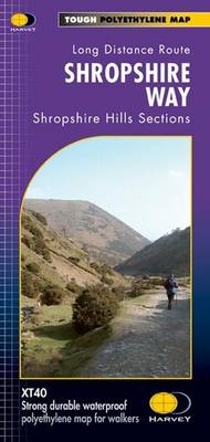
Shropshire Way
Shropshire Hills Sections
Seiten
2011
Harvey Map Services Ltd (Verlag)
978-1-85137-507-3 (ISBN)
Harvey Map Services Ltd (Verlag)
978-1-85137-507-3 (ISBN)
- Titel erscheint in neuer Auflage
- Artikel merken
Zu diesem Artikel existiert eine Nachauflage
Shropshire has over 3500 miles of rights of way. A quarter of the county is designated the Shropshire Hills AONB so the route covered by this map runs through some of the most beautiful and varied landscapes anywhere in Britain. The Shropshire Way is an extensive tour of the county combining bracing hill sections with gentler walking in the valleys which form a variety of ways to explore the Shropshire Hills. The HARVEY series of Long Distance Route maps is an established success. Now the advanced technology used in the creation of our best - selling British Mountain Maps is also applied to the route maps. These maps are a leap forward in technical excellence. They are tough, durable, light and 100% waterproof - virtually indestructible in normal use. They are light to carry and compact - not the great bulky package you get with a laminated map. The map is detailed, with the routes clearly marked. It also contains general information, useful telephone numbers and a full key.
| Erscheint lt. Verlag | 21.6.2011 |
|---|---|
| Reihe/Serie | Trail Map XT40 |
| Verlagsort | Perthshire |
| Sprache | englisch |
| Maße | 115 x 245 mm |
| Gewicht | 60 g |
| Themenwelt | Sachbuch/Ratgeber ► Sport |
| Reisen ► Karten / Stadtpläne / Atlanten ► Europa | |
| ISBN-10 | 1-85137-507-4 / 1851375074 |
| ISBN-13 | 978-1-85137-507-3 / 9781851375073 |
| Zustand | Neuware |
| Haben Sie eine Frage zum Produkt? |
Mehr entdecken
aus dem Bereich
aus dem Bereich
Straßen- und Freizeitkarte 1:250.000
Karte (gefalzt) (2023)
Freytag-Berndt und ARTARIA (Verlag)
12,90 €
Karte (gefalzt) (2023)
Freytag-Berndt und ARTARIA (Verlag)
12,90 €
Östersund
Karte (gefalzt) (2023)
Freytag-Berndt und ARTARIA (Verlag)
12,90 €


