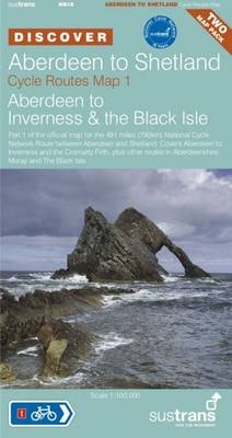
Aberdeen to Shetland
Sustrans' Cycle Route Map
2010
Sustrans (Verlag)
978-1-901389-81-4 (ISBN)
Sustrans (Verlag)
978-1-901389-81-4 (ISBN)
- Titel ist leider vergriffen;
keine Neuauflage - Artikel merken
Includes the official route maps covering the 491 miles (790 km) of National Cycle Network Route between Aberdeen to Shetland - Sustrans' route NN1E.
This title includes the official route maps (a two map pack) covering the 491 miles (790 km) of National Cycle Network Route between Aberdeen to Shetland - Sustrans' route NN1E. Part of the "Discover" series from Sustrans, in 1:100,000 and 1:175,000 scale, the maps show gradient profiles and visitor information, with detailed routes through towns and cities. The routes are largely waymarked with the familiar blue Sustrans' signs, on traffic-free paths, quiet lanes and roads. Map 1 covers Aberdeen to Inverness and the Cromarty Firth, plus other routes in Aberdeenshire, Moray and The Black Isle. Map 2 covers the Cromarty Firth to John O'Groats, and the islands of Orkney and Shetland.
This title includes the official route maps (a two map pack) covering the 491 miles (790 km) of National Cycle Network Route between Aberdeen to Shetland - Sustrans' route NN1E. Part of the "Discover" series from Sustrans, in 1:100,000 and 1:175,000 scale, the maps show gradient profiles and visitor information, with detailed routes through towns and cities. The routes are largely waymarked with the familiar blue Sustrans' signs, on traffic-free paths, quiet lanes and roads. Map 1 covers Aberdeen to Inverness and the Cromarty Firth, plus other routes in Aberdeenshire, Moray and The Black Isle. Map 2 covers the Cromarty Firth to John O'Groats, and the islands of Orkney and Shetland.
| Zusatzinfo | colour strip maps |
|---|---|
| Verlagsort | Bristol |
| Sprache | englisch |
| Maße | 125 x 235 mm |
| Themenwelt | Sachbuch/Ratgeber ► Sport ► Motor- / Rad- / Flugsport |
| ISBN-10 | 1-901389-81-2 / 1901389812 |
| ISBN-13 | 978-1-901389-81-4 / 9781901389814 |
| Zustand | Neuware |
| Haben Sie eine Frage zum Produkt? |
Mehr entdecken
aus dem Bereich
aus dem Bereich
Karte (gefalzt) (2023)
BVA BikeMedia (Verlag)
10,95 €
Karte (gefalzt) (2023)
BVA BikeMedia (Verlag)
11,95 €
4in1 Wanderkarte : mit Aktiv Guide und Detailkarten : inklusive Karte …
Karte (gefalzt) (2023)
Kompass-Karten (Verlag)
12,95 €
![Uckermark, 1:75.000 [offizielle Karte des ADFC, Allgemeiner Deutscher Fahrrad-Club] - ADFC - Allgemeiner Deutscher Fahrrad-Club e.V.](/media/107442469)

