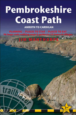
Pembrokeshire Coast Path
Amroth to Cardigan: Planning, Places to Stay, Places to Eat
Seiten
2010
|
3rd edition
Trailblazer Publications (Verlag)
978-1-905864-27-0 (ISBN)
Trailblazer Publications (Verlag)
978-1-905864-27-0 (ISBN)
- Titel ist leider vergriffen;
keine Neuauflage - Artikel merken
Fully revised and rewalked 3rd edition of this comprehensive walking guide to Pembrokeshire Coast Path in south-west Wales. Now with GPS waypoints. Includes 96 walking maps, itineraries for all walkers, and practical information for all budgets - what to see, where to stay and where to eat.
Fully revised and rewalked 3rd edition of this comprehensive walking guide to Pembrokeshire Coast Path in south-west Wales, with some of the best coastal walking in Britain. Includes 96 walking maps - the largest-scale maps available (1:20,000), with unique mapping features - walking times, directions, tricky junctions, places to stay, places to eat, points of interes; itineraries for all walkers - whether hiking the 186-mile route in its entirety or sampling the highlights on day walks or short breaks, and detailed public transport information for all access points; practical information for all budgets - what to see, where to stay and where to eat: pubs, hotels, B&Bs, camping, bunkhouses, hostels. Now with GPS waypoints for the complete path. Plus 16pp full colour photos including 4 page wild flower and butterfly identification guide.
Fully revised and rewalked 3rd edition of this comprehensive walking guide to Pembrokeshire Coast Path in south-west Wales, with some of the best coastal walking in Britain. Includes 96 walking maps - the largest-scale maps available (1:20,000), with unique mapping features - walking times, directions, tricky junctions, places to stay, places to eat, points of interes; itineraries for all walkers - whether hiking the 186-mile route in its entirety or sampling the highlights on day walks or short breaks, and detailed public transport information for all access points; practical information for all budgets - what to see, where to stay and where to eat: pubs, hotels, B&Bs, camping, bunkhouses, hostels. Now with GPS waypoints for the complete path. Plus 16pp full colour photos including 4 page wild flower and butterfly identification guide.
A keen outdoorsman, Jim Manthorpe works as a ranger in Knoydart, one of the most remote regions of Scotland.
| Erscheint lt. Verlag | 26.1.2010 |
|---|---|
| Reihe/Serie | British Walking Guides |
| Zusatzinfo | Illustrations, maps |
| Verlagsort | Hindhead, Surrey |
| Sprache | englisch |
| Maße | 120 x 180 mm |
| Themenwelt | Sachbuch/Ratgeber ► Sport |
| Reiseführer ► Europa ► Großbritannien | |
| ISBN-10 | 1-905864-27-2 / 1905864272 |
| ISBN-13 | 978-1-905864-27-0 / 9781905864270 |
| Zustand | Neuware |
| Haben Sie eine Frage zum Produkt? |
Mehr entdecken
aus dem Bereich
aus dem Bereich
individuell reisen mit vielen praktischen Tipps
Buch | Softcover (2024)
Michael Müller (Verlag)
29,90 €


