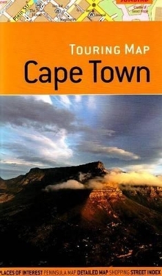
Touring Map of Cape Town
2nd Edition
2008
Sunbird Publishers Ltd (Verlag)
978-1-919938-75-2 (ISBN)
Sunbird Publishers Ltd (Verlag)
978-1-919938-75-2 (ISBN)
- Titel ist leider vergriffen;
keine Neuauflage - Artikel merken
A folded road map of Cape Town. It features one-way systems, traffic lights and car parking centres; shopping centres, places and buildings of interest, petrol garages, phone kiosks, schools, post office and post collection boxes; and, banks, cash points, foreign currency exchange centres, places of worship and street numbers.
Scale 1:5000. A folded road map of Cape Town featuring: One-way systems, traffic lights and car parking centres; Shopping centres, places and buildings of interest, petrol garages, phone kiosks, schools, post office and post collection boxes; Banks, cash points, foreign currency exchange centres, places of worship and street numbers to help locate an address; Scenic photographs of popular places; Cape Peninsula map (1:200 000); Street index of the town centre.
Scale 1:5000. A folded road map of Cape Town featuring: One-way systems, traffic lights and car parking centres; Shopping centres, places and buildings of interest, petrol garages, phone kiosks, schools, post office and post collection boxes; Banks, cash points, foreign currency exchange centres, places of worship and street numbers to help locate an address; Scenic photographs of popular places; Cape Peninsula map (1:200 000); Street index of the town centre.
| Erscheint lt. Verlag | 30.6.2008 |
|---|---|
| Zusatzinfo | colour photos |
| Verlagsort | Cape Town |
| Sprache | englisch |
| Maße | 235 x 140 mm |
| Gewicht | 100 g |
| Themenwelt | Reisen ► Karten / Stadtpläne / Atlanten ► Afrika |
| ISBN-10 | 1-919938-75-3 / 1919938753 |
| ISBN-13 | 978-1-919938-75-2 / 9781919938752 |
| Zustand | Neuware |
| Haben Sie eine Frage zum Produkt? |
Mehr entdecken
aus dem Bereich
aus dem Bereich
Karte (gefalzt) (2024)
Freytag-Berndt und ARTARIA (Verlag)
12,90 €
Karte (gefalzt) (2023)
Freytag-Berndt und ARTARIA (Verlag)
12,90 €
reiß- und wasserfest (world mapping project)
Karte (gefalzt) (2024)
Reise Know-How (Verlag)
14,00 €


