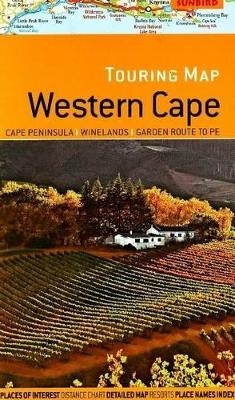
Touring map Western Cape
Cape Peninsula; Winelands; Garden Route; PE
2008
Sunbird Publishers Ltd (Verlag)
978-1-919938-85-1 (ISBN)
Sunbird Publishers Ltd (Verlag)
978-1-919938-85-1 (ISBN)
- Titel ist leider vergriffen;
keine Neuauflage - Artikel merken
Contains a folded road map that features an easy-to-read road network with road numbers and distances on main routes. This title presents places of interest, water features, national parks and nature reserves; street plan of principle cities; distance chart; and, area maps of the Cape Peninsula and Garden Route to Port Elizabeth.
Scale: 1:750,000. A folded road map featuring: Easy-to-read, detailed road network with road numbers and distances on main routes; Places of interest, water features, national parks and nature reserves; Street plan of principle cities; Distance chart; Detailed area maps of the Cape Peninsula, Garden Route to Port Elizabeth, and Franschhoek Paarl Stellenbosch wine region; Town plan of Cape Town; Place name index; Distance chart.
Scale: 1:750,000. A folded road map featuring: Easy-to-read, detailed road network with road numbers and distances on main routes; Places of interest, water features, national parks and nature reserves; Street plan of principle cities; Distance chart; Detailed area maps of the Cape Peninsula, Garden Route to Port Elizabeth, and Franschhoek Paarl Stellenbosch wine region; Town plan of Cape Town; Place name index; Distance chart.
| Erscheint lt. Verlag | 19.5.2008 |
|---|---|
| Verlagsort | Cape Town |
| Sprache | englisch |
| Maße | 140 x 235 mm |
| Gewicht | 500 g |
| Themenwelt | Reisen ► Karten / Stadtpläne / Atlanten ► Afrika |
| ISBN-10 | 1-919938-85-0 / 1919938850 |
| ISBN-13 | 978-1-919938-85-1 / 9781919938851 |
| Zustand | Neuware |
| Haben Sie eine Frage zum Produkt? |
Mehr entdecken
aus dem Bereich
aus dem Bereich
Karte (gefalzt) (2024)
Freytag-Berndt und ARTARIA (Verlag)
12,90 €
Karte (gefalzt) (2023)
Freytag-Berndt und ARTARIA (Verlag)
12,90 €
reiß- und wasserfest (world mapping project)
Karte (gefalzt) (2024)
Reise Know-How (Verlag)
14,00 €


