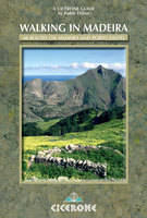
Walking in Madeira
Cicerone Press (Verlag)
978-1-85284-531-5 (ISBN)
- Titel ist leider vergriffen;
keine Neuauflage - Artikel merken
This book describes a varied selection of 60 walks to suit all abilities, covering the whole of Madeira and Porto Santo, as well as a cruise to the Ilhas Desertas. The routes explore the dramatic cliff coastline, wander along level levada paths, penetrate dense laurisilva forests and traverse stone-paved paths from peak to peak in the high mountains. Most of the walks on the island are linear, and most of them start and finish on bus routes. The steep and rugged mountainsides of Madeira do not easily support circular walks. The guide offers a comprehensive introduction to Madeira and Porto Santo in 7 sections, lavishly illustrated with photographs and contoured maps, showing options for linking routes for longer treks, and almost 800km (500 miles) of walking on a variety of terrains.
Paddy Dillon is a guidebook writer, with over 40 books to his name, and contributions to 25 more. He has written for a number of outdoor magazines and appeared on radio and television. Paddy has visited Madeira several times over the years, exploring extensively and enjoying the vast variety of walking routes and landscape types around the islands.
Contents
Preface to the second edition
Introduction
Location
Geology
History
Landscape
Trees and Flowers
Birds
Animals
Parque Natural da Madeira
Funchal and Monte
Practicalities
Getting to Madeira
Getting around Madeira
Accommodation
Currency
Language
Food and Drink
Weather
Tourist Information
Health Issues
Emergencies
Porto Santo
Maps of Madeira
Using this Guide
Making Multi-day Trips
SECTION 1 Eastern Madeira
1 Levada dos Tornos: Monte to Camacha
2 Levada dos Tornos: Camacha to Quatro Estradas
3 Levada da Serra: Campo do Pomar to Camacha
4 Levada da Serra: Camacha to Santo da Serra
5 Levada Nova: Quatro Estradas to Santo da Serra
6 Baia d'Abra and Ponta de São Lourenço
7 Levada do Caniçal: Maroços to Caniçal
8 Levada da Portela: Santo da Serra to Portela
9 Vereda das Funduras: Portela to Maroços
10 North Coast: Porto da Cruz to Ribeira Seca
SECTION 2 Funchal to Santana
11 Vereda da Penha d'águia
12 Levada do Furado: Portela to Ribeiro Frio
13 Caminho Velha: Poiso to Porto da Cruz
14 Fajã da Nogueira and Levada da Serra
15 Caminho Velha: Poiso to Santana
16 Levada do Barreiro: Poço da Neve to Monte
17 Levada da Negra: Poço da Neve to Barreira
18 Levada do Curral: Curral das Freiras to Funchal
19 Levada dos Piornais: Lombada to Funchal
SECTION 3 The High Mountains
20 Boca da Encumeada to Achada do Teixeira
21 Boca da Encumeada to Curral das Freiras
22 Pico do Cedro and Pico do Areeiro
23 Pico do Areeiro to Pico Ruivo
24 Pico Ruivo, Vale da Lapa and Ilha
25 Pico Ruivo, Queimadas and Santana
26 Levada do Caldeirão Verde from Pico das Pedras
27 Levada do Rei from Quebradas
28 Santana, Calhau and São Jorge
29 Boca da Encumeada and Pico Grande
30 Colmeal and Pico Grande
31 Curral das Freiras to Boaventura
32 Boca da Encumeada to Colmeal
SECTION 4 Jardim da Serra
33 Boca da Encumeada to Marco e Fonte
34 Boca da Corrida and Curral das Freiras
35 Boca dos Namorados and Curral das Freiras
36 Marco e Fonte to Fontes
37 Terreiros from Boca da Corrida
38 Crista do Espigão from Fontes
39 Levada do Norte: Serra de água to Boa Morte
40 Levada do Norte: Boa Morte to Estreito de Câmara de Lobos
SECTION 5 Paúl da Serra
41 Pico Ruivo do Paúl da Serra from Pico da Urze
42 Rabaçal, Levada do Risco and 25 Fontes
43 Levada do Paúl: Rabaçal to Cristo Rei
44 Levada das Rabaças: Cristo Rei to Boca da Encumeada
45 Caminho do Pináculo e Folhadal
46 Levada dos Cedros: Fanal to Ribeira da Janela
47 Levada da Janela: Fonte do Bispo to Porto Moniz
SECTION 6 Western Madeira
48 Ponta do Pargo to Fonte do Bispo
49 Levada do Moinho: Tornadouro to Ribeira da Cruz
50 Levada Calheta/Ponta do Pargo to Ponta do Pargo
51 Levada Calheta/Ponta do Pargo to Prazéres
52 Caminho Real: Prazéres to Paúl do Mar
53 Levada Calheta/Ponta do Pargo to Lombo dos Faias
54 Levada Calheta/Ponta do Pargo to Ponta do Sol
55 Levada Nova and Levada do Moinho from Ponta do Sol
56 Levada Nova: Jangão to Ribeira Brava
57 Lombo do Mouro to Ribeira Brava
SECTION 7 Porto Santo
58 Pico do Castelo, Pico do Facho and Pico Branco
59 Campo de Baixo, Bárbara Gomes and Eiras
60 Ponta, Pico de Ana Ferreira, Espigão and Calheta
Cruise to the Ilhas Desertas
Appendix 1 Quick reference guide to routes
Appendix 2 Language Notes
Appendix 3 Useful Contacts
| Erscheint lt. Verlag | 5.7.2016 |
|---|---|
| Zusatzinfo | Over 100 colour photos and 30+ contour maps |
| Verlagsort | Kendal |
| Sprache | englisch |
| Maße | 116 x 172 mm |
| Gewicht | 380 g |
| Themenwelt | Sachbuch/Ratgeber ► Sport |
| Reisen ► Reiseführer ► Welt / Arktis / Antarktis | |
| ISBN-10 | 1-85284-531-7 / 1852845317 |
| ISBN-13 | 978-1-85284-531-5 / 9781852845315 |
| Zustand | Neuware |
| Haben Sie eine Frage zum Produkt? |
aus dem Bereich


