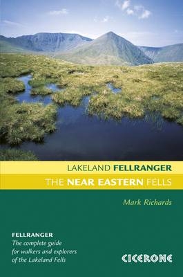
The Near Eastern Fells
Cicerone Press (Verlag)
978-1-85284-541-4 (ISBN)
- Titel ist leider vergriffen;
keine Neuauflage - Artikel merken
Lakeland Fellranger guidebook covering 35 summits in the Near Eastern Fells of the Lake District, including a variety of walks in the mighty range of hills including Helvellyn, Hart Side and Fairfield, that sit between Ambleside, Ullswater and Grasmere. The area is flanked to the west by Grasmere, Dunmail Raise and Thirlmere, and to the east by Kirkstone Pass, Patterdale and Ullswater.
Each of the 35 fells has a dedicated chapter describing a plethora of walking routes of differing characters and difficulties (from wide bridleways up to easy scrambles), which can easily be combined to make ascents, descents, traverses or ridge routes. The chapter begins with a customised Harvey map that illustrates the routes, and shows ridge connections to neighbouring fells to assist in the planning of extended walks.
In many instances pen and ink drawn diagrams show the routes from a given perspective to assist visualisation. The guidebook is fully illustrated throughout with clear elevation diagrams, detailed summit panoramas and lots of inspiring photographs.
The Near Eastern Fells is part of the eight-volume Lakeland Fellranger series by Mark Richards. Together they provide a comprehensive guide to explore and enjoy the fells of the Lake District, with a selection of routes up more than 220 hills.
Mark Richards moved to Cumbria in the early 1990s. Here he developed a passion for the finest of all walking landscapes, held within and around this marvellous county. Mark is well known for his guides to the Peak District and Hadrian's Wall. He is a founder of the Hadrian's Wall Trust, a member of the Outdoor Writers and Photographers Guild and broadcasts on BBC Radio Cumbria.
From fireside to fellside
This guide
Fix the Fells
Access
Safety
Starting points
1 Arnison Crag 434m/1424ft
2 Birkhouse Moor 718m/2356ft
3 Birks 622m/2241ft
4 Catstycam 890m/2920ft
5 Clough Head 726m/2386ft
6 Dollywaggon Pike 858m/2815ft
7 Dove Crag 792m/2599ft
8 Fairfield 873m/2864ft
9 Glenridding Dodd 442m/1450ft
10 Gowbarrow Fell 481m/1578ft
11 Great Dodd 857m/2812ft
12 Great Mell Fell 537m/1762ft
13 Great Rigg 767m/2516ft
14 Hart Crag 822m/2697ft
15 Hart Side 758m/2487ft
16 Hartsop above How 586m/1923ft
17 Helvellyn 950m/3116ft
18 Heron Pike 621m/2037ft
19 High Hartsop Dodd 519m/1703ft
20 High Pike 656m/2152ft
21 Little Hart Crag 637m/2090ft
22 Little Mell Fell 505m/1657ft
23 Low Pike 507m/1663ft
24 Middle Dodd 653m/2143ft
25 Nab Scar 455m/1490ft
26 Nethermost Pike 891m/2923ft
27 Raise 884m/2900ft
28 Red Screes 777m/2549ft
29 Seat Sandal 736m/2415ft
30 Sheffield Pike 675m/2215ft
31 St Sunday Crag 841m/2759ft
32 Stone Arthur 503m/1650ft
33 Stybarrow Dodd 846m/2776ft
34 Watson's Dodd 789m/2589ft
35 White Side 863m/2831ft
Index
| Erscheint lt. Verlag | 19.1.2015 |
|---|---|
| Zusatzinfo | 35 Harvey map extracts, plus elevations and summit panoramas |
| Verlagsort | Kendal |
| Sprache | englisch |
| Maße | 130 x 196 mm |
| Gewicht | 520 g |
| Themenwelt | Sachbuch/Ratgeber ► Sport |
| Reiseführer ► Europa ► Großbritannien | |
| ISBN-10 | 1-85284-541-4 / 1852845414 |
| ISBN-13 | 978-1-85284-541-4 / 9781852845414 |
| Zustand | Neuware |
| Haben Sie eine Frage zum Produkt? |
aus dem Bereich


