


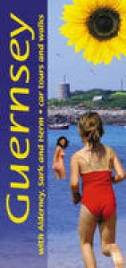
Guernsey, with Alderney, Sark and Herm
Car Tours and Walks
Seiten
2008
|
4th Revised edition
Sunflower Books (Verlag)
978-1-85691-344-7 (ISBN)
Sunflower Books (Verlag)
978-1-85691-344-7 (ISBN)
- Titel erscheint in neuer Auflage
- Artikel merken
Zu diesem Artikel existiert eine Nachauflage
Pocket-sized full-colour guide describing car tours, walks and countryside picnics. Large-scale topographical walking maps (scale 1:50,000), fold-out touring map. Timetables for local transport. Unique free on-line update service with specific route change information. Series (50 destinations) dubbed 'the blue Bibles' by the Sunday Times.
Pocket-sized and in full colour, this guide describes a car tour around Guernsey's coast (with accompanying fold-out touring map) and days out on the nearby islands of Alderney, Sark and Herm. But the major part of the book is devoted to 11 walks on Guernsey and one each on the other three islands, all illustrated with OS maps (1:25,000) - a boon, since these maps are no longer in print. An ideal introduction for the first-time visitor, the book also provides new ideas for those who come year after year. Apart from marvellous coastal scenery that's been compared to that of Cornwall and Brittany, there is much to explore of the island's past. For example, you could follow some of Guernsey's 'green lanes' and 'water lanes' - centuries-old paths once used by pack-horses and donkeys, or follow a route that takes in the relics of prehistoric burial grounds as well as remnants of the German Occupation during World War II. Guernsey's coastline provides challenging cliff paths with steep climbs and lots of steps. Elsewhere the walking is very easy, since the terrain is almost level. The best time to walk is in the spring, especially April/May for the flowers.
But walking is enjoyable through to October, and even in the winter months if you don't mind showers and bracing breezes. The book contains timetables for local transport, and a unique free on-line update service keeps users abreast of any route changes since publication.
| Erscheint lt. Verlag | 15.3.2008 |
|---|---|
| Reihe/Serie | Landscapes |
| Zusatzinfo | col. Illustrations, col. maps |
| Verlagsort | London |
| Sprache | englisch |
| Maße | 100 x 210 mm |
| Themenwelt | Reisen ► Karten / Stadtpläne / Atlanten ► Europa |
| ISBN-10 | 1-85691-344-9 / 1856913449 |
| ISBN-13 | 978-1-85691-344-7 / 9781856913447 |
| Zustand | Neuware |
| Haben Sie eine Frage zum Produkt? |
Mehr entdecken
aus dem Bereich


aus dem Bereich
Buch | Spiralbindung (2024)
Freytag-Berndt und ARTARIA (Verlag)
29,90 €