The Corbett Almanac
Seiten
1999
|
2nd Revised edition
Neil Wilson Publishing (Verlag)
978-1-897784-72-3 (ISBN)
Neil Wilson Publishing (Verlag)
978-1-897784-72-3 (ISBN)
- Titel ist leider vergriffen;
keine Neuauflage - Artikel merken
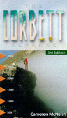
The author details the 220 Corbetts which exist in Scotland. These hills between 2500 and 2999 feet are among the most popular and accessible as they are gentler than the Munros. The book covers Scotland on a regional basis, usually around a town well suited to accommodating hillwalkers.
The author details the 220 Corbetts which exist in Scotland. These hills between 2500 and 2999 feet high are amongst the most popular and accessible since they are often a good afternoon's exercise as opposed to the generally more testing and trying Munros which are frequently situated in more extreme terrain. The book covers Scotland on a regional basis, usually around a town which is well suited to accommodating hillwalkers. These areas are: The Southern Uplands; Arrochar; Crianlarich, Tyndrum and Bridge of Orchy; Strathyre and Loch Earn; Rannoch and Glen Lyon; Killin; Etive and Glen Coe; Loch Trieg and Loch Ossian; Loch Ericht and Drumochter; Pitlochy, Tarff and Tilt; Cairnwell, Glenshee and Lochnagar; Norther Cairngorms; Southern Cairngorms; Glen Roy, Laggan and Monadhiliath; Loch Lochy; Loch Arkaig and Loch Eil; Ardgour, Moidart and Loch Sheil; Knoydart and Loch Quoich; Glen Sheil; Glen Affric and Strathfarar; Achnashellach, Torridon and Applecross; Dundonnell and Fisherfield; The Fannichs and Ullapool; Assynt and the Far North; The Islands. Gaelic pronunciations are given with Ordnance Survey references, ascent and descent times, maps and stalking information.
The author details the 220 Corbetts which exist in Scotland. These hills between 2500 and 2999 feet high are amongst the most popular and accessible since they are often a good afternoon's exercise as opposed to the generally more testing and trying Munros which are frequently situated in more extreme terrain. The book covers Scotland on a regional basis, usually around a town which is well suited to accommodating hillwalkers. These areas are: The Southern Uplands; Arrochar; Crianlarich, Tyndrum and Bridge of Orchy; Strathyre and Loch Earn; Rannoch and Glen Lyon; Killin; Etive and Glen Coe; Loch Trieg and Loch Ossian; Loch Ericht and Drumochter; Pitlochy, Tarff and Tilt; Cairnwell, Glenshee and Lochnagar; Norther Cairngorms; Southern Cairngorms; Glen Roy, Laggan and Monadhiliath; Loch Lochy; Loch Arkaig and Loch Eil; Ardgour, Moidart and Loch Sheil; Knoydart and Loch Quoich; Glen Sheil; Glen Affric and Strathfarar; Achnashellach, Torridon and Applecross; Dundonnell and Fisherfield; The Fannichs and Ullapool; Assynt and the Far North; The Islands. Gaelic pronunciations are given with Ordnance Survey references, ascent and descent times, maps and stalking information.
| Erscheint lt. Verlag | 8.6.1999 |
|---|---|
| Zusatzinfo | 30 colour illustrations, 30 maps |
| Verlagsort | Glasgow |
| Sprache | englisch |
| Maße | 100 x 180 mm |
| Themenwelt | Sachbuch/Ratgeber ► Sport |
| Reiseführer ► Europa ► Großbritannien | |
| Reiseführer ► Europa ► Schottland | |
| ISBN-10 | 1-897784-72-4 / 1897784724 |
| ISBN-13 | 978-1-897784-72-3 / 9781897784723 |
| Zustand | Neuware |
| Haben Sie eine Frage zum Produkt? |
Mehr entdecken
aus dem Bereich
aus dem Bereich
individuell reisen mit vielen praktischen Tipps
Buch | Softcover (2024)
Michael Müller (Verlag)
29,90 €
Reiseführer mit Stadtplan, 4 Spaziergängen und kostenloser Web-App
Buch | Softcover (2023)
Reise Know-How (Verlag)
15,95 €


