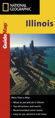
Illinois
State Guide Maps
Seiten
2012
National Geographic Maps (Verlag)
978-0-7922-3564-4 (ISBN)
National Geographic Maps (Verlag)
978-0-7922-3564-4 (ISBN)
- Keine Verlagsinformationen verfügbar
- Artikel merken
While GPS is handy for navigating unfamiliar cities, there is nothing better than a printed map for simplicity, perspective and fun on road trips. National Geographic's State Guide Maps are the perfect combination of detailed map and travel guide. Each map contains scenic drives, parks and recreation maps, as well as insets of cities and useful information on local attractions and events. The maps are printed on durable, waterproof, tear-resistant material that is lightweight and easily folded to fit in your pocket.
| Erscheint lt. Verlag | 2.8.2012 |
|---|---|
| Verlagsort | Evergreen |
| Sprache | englisch |
| Maße | 105 x 228 mm |
| Gewicht | 67 g |
| Themenwelt | Reisen ► Karten / Stadtpläne / Atlanten ► Nord- / Mittelamerika |
| ISBN-10 | 0-7922-3564-9 / 0792235649 |
| ISBN-13 | 978-0-7922-3564-4 / 9780792235644 |
| Zustand | Neuware |
| Haben Sie eine Frage zum Produkt? |
Mehr entdecken
aus dem Bereich
aus dem Bereich
Karte (gefalzt) (2024)
Freytag-Berndt und ARTARIA (Verlag)
12,90 €
Karte (gefalzt) (2023)
Reise Know-How (Verlag)
12,00 €
Karte (gefalzt) (2023)
Reise Know-How (Verlag)
12,00 €


