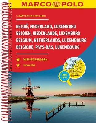
MARCO POLO Reiseatlas Benelux, Belgien, Niederlande, Luxemburg 1:200 000
MAIRDUMONT (Verlag)
978-3-8297-3702-9 (ISBN)
- Titel ist leider vergriffen;
keine Neuauflage - Artikel merken
Fully revised and updated... now with ZOOM system for even better orientation!
Marco Polo maps and atlases feature completely up-to-date, digitally generated mapping. The high quality cartography with distance indicators and scale converters aid route planning. New ZOOM System - all large urban areas are marked on the main maps and are cross-referenced to separate transit maps which zoom in on the city to aid route planning. We then zoom in further to detailed city maps which are listed alphabetically at the back of the atlas.
Major sights and key points of interest are marked on the maps and these are listed at the front of the atlas with a brief description to help travellers pick the best places to see en route. Comprehensive index. The map scale is 1: 200 000.
Marco Polo Travel Publishing offers a wide range of high quality cartographic products and travel guides. Marco Polo Pocket Guides are known for their handy, compact format and Insider Tips. Our Travel Handbooks are the first to include infographics and our Spiral Guides feature unique lay-flat spiral binding. Marco Polo Maps are famous for the high quality of cartography in their Country, City and Holiday Maps.
Der Kartenteil: Hauptkarte im Maßstab 1:200 000 mit mehrsprachiger Legende (D, GB, I, F, NL, E, P, CZ, PL, H, DK, S)/ Kartenübersicht und Verwaltungsgliederung/ Fernfahrtenkarte mit Kartenübersicht/ 2 Stadtumgebungskarten: - Amsterdam - Brussel/Bruxelles/ 15 Citypläne 1:20 000 mit mehrsprachiger Legende: - Amsterdam - Antwerpen - Arnhem - Brugge - Brussel/Bruxelles - Eindhoven - Gent - Groningen - Den Haag ('s-Gravenhage) - 's-Hertogenbosch - Liège - Luxemburg - Maastricht - Utrecht - Rotterdam/ Kartenteil Europa 1:4 500 000; Der Serviceteil: Tabelle der Entfernungen und Fahrzeiten/ Verkehrsinformationen Benelux/ Ortsregister für die Länder B, NL, L mit Provinz, Postleitzahl und Suchfeldangabe/ Ausgewählte Sehenswürdigkeiten, Landschafts- und Gewässernamen mit Suchfeldangabe
| Erscheint lt. Verlag | 5.11.2015 |
|---|---|
| Reihe/Serie | MARCO POLO Reiseatlanten |
| Verlagsort | Ostfildern |
| Sprache | deutsch |
| Maße | 220 x 298 mm |
| Gewicht | 470 g |
| Themenwelt | Reisen ► Karten / Stadtpläne / Atlanten ► Europa |
| Schlagworte | Atlas • Atlas Benelux • Belgien • Benelux • Benelux; Autoatlas • Grachten • Ijsselmeer • Karten Benelux • Karten, Globen / Karten, Stadtpläne, Atlanten/Europa • KTN/Karten, Stadtpläne, Atlanten/Europa • Land • Luxemburg • Marco Polo • Niederlande • Polder • Reiseatlas • Straßenatlas • Urlaub Belgien • Urlaub Luxemburg • Urlaub Niederlande |
| ISBN-10 | 3-8297-3702-5 / 3829737025 |
| ISBN-13 | 978-3-8297-3702-9 / 9783829737029 |
| Zustand | Neuware |
| Informationen gemäß Produktsicherheitsverordnung (GPSR) | |
| Haben Sie eine Frage zum Produkt? |
aus dem Bereich


