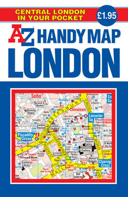
Handy Map of Central London
Seiten
2019
|
25th Revised edition
Geographers' A-Z Map Co Ltd (Verlag)
978-1-84348-473-8 (ISBN)
Geographers' A-Z Map Co Ltd (Verlag)
978-1-84348-473-8 (ISBN)
- Titel erscheint in neuer Auflage
- Artikel merken
Zu diesem Artikel existiert eine Nachauflage
This A-Z Handy Map of Central London is a full colour, double sided, fold-out street map designed especially with the tourist in mind. The main map extends to include Regent's Park to the north, Tower Bridge to the east, Tate Britain to the south and Paddington station to the west.
This self cover edition includes coloured foldout mapping of central London that is designed especially for the tourist and covers an area extending to Regent's Park, King's Cross, The Barbican, Spitalfields, Tower Bridge, The South Bank, Waterloo Station, Westminster, South Kensington, Paddington Station and Lord's Cricket Ground.
Road information shown includes A and B roads, bus routes and a selection of principal minor roads. Buildings open to the public, places of interest, theatres, cinemas, selected shops and stores, main shopping streets and other locations of interest to the visitor are a feature of this map. A detailed street map of the central area is included.
The index to the map is on the reverse and has separate lists of streets, places of interest, cinemas, theatres and stations (which include London Underground, National Rail and Docklands Light Railway stations). Also featured on the reverse are a selection of coloured photographs of tourist sites, a Central London Bus Routes map and helpful text panels headed: Tourist Information, Transport Information and Shopping. A central London Underground Map is printed on the back cover.
Britain’s leading street map publisher providing cartographic services, digital data products and paper mapping publications (including Street Atlases, Visitors Guides, Great Britain Road Atlases and The Adventure Atlas).
| Erscheint lt. Verlag | 6.2.2019 |
|---|---|
| Reihe/Serie | Street Maps & Atlases S. |
| Sprache | englisch |
| Maße | 104 x 173 mm |
| Themenwelt | Reisen ► Karten / Stadtpläne / Atlanten ► Europa |
| ISBN-10 | 1-84348-473-0 / 1843484730 |
| ISBN-13 | 978-1-84348-473-8 / 9781843484738 |
| Zustand | Neuware |
| Haben Sie eine Frage zum Produkt? |
Mehr entdecken
aus dem Bereich
aus dem Bereich
Buch | Spiralbindung (2024)
Freytag-Berndt und ARTARIA (Verlag)
29,90 €


