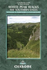
White Peak Walks Vol 2 Southern Dales
Cicerone Press (Verlag)
978-0-902363-88-5 (ISBN)
- Titel erscheint in neuer Auflage
- Artikel merken
Even though increased mobility has extended the diversity (in terms of sights and sites) of beautiful countryside within range of the millions who inhabit middle England, the White Peak remains tremendously popular among casual walking visitors. The area offers an amiable landscape despite the vagaries of its climate, dissected by countless walls, abundant in pastures and woodland, its limestone outcrops completing the interplay of green and white. It also offers a well-maintained footpath network. The 'net' effect ensures that walkers feel at ease and relaxed in their wanderings as in few other places in England. The boundaries of this guide are defined on the east by the long spine of Axe Edge and Morridge, to the south by the Weaver Hills and Ashbourne, continuing north-eastward with the B5035 to Cromford and Matlock, cutting west via Youlgreave to Parsley Hay and Earl Sterndale back to the source of the Dove. This is predominantly limestone country, with only the shale uplands west of the upper Dove and lower Manifold and the gritstone of Harthill and Stanton Moors to lend contrast.
To strong walkers, the selection of outings may seem of modest ambition, but for the majority of casual visitors they will be found to be of perfect length for refreshing exercise and a gentle introduction to this truly beautiful walking region.
Mark Richards' transition from full-time farmer to full-time outdoor writer has been a gradual one. In 1973, with the direct encouragement of Alfred Wainwright, he wrote his first walking guide to the Cotswold Way. Since then he has indulged his pleasure in exploring rural Britain by creating a range of walking guides. In 1980 he began his three-part guide to the Peak District for Cicerone Press, and in 1987, with Chris Wright, wrote a guide to walking around the former county of Westmorland. This book sowed the seeds of a dream, to be fulfilled some 14 years later, when he and his wife moved to Cumbria. Here he developed a passion for the finest of all walking landscapes, held within and around this marvellous county. Mark has written a Cicerone guide to Great Mountain Days in the Lake District and, after many years of dedicated research, completed his Lakeland Fellranger series of eight guides covering the entire region in 2013. Now living in what was once the Barony of Gilsland, Mark is also close to Hadrian's Wall, enabling him to renew a fascination first kindled when he prepared a guide to walking the Wall in 1993. He has also published a guide to the Wall for Cicerone.
Map locating the start of the walks
Introduction
Symbols on the route maps
| Erscheint lt. Verlag | 1.1.2004 |
|---|---|
| Verlagsort | Kendal |
| Sprache | englisch |
| Maße | 116 x 172 mm |
| Gewicht | 340 g |
| Themenwelt | Sachbuch/Ratgeber ► Sport |
| Reiseführer ► Europa ► Großbritannien | |
| ISBN-10 | 0-902363-88-3 / 0902363883 |
| ISBN-13 | 978-0-902363-88-5 / 9780902363885 |
| Zustand | Neuware |
| Haben Sie eine Frage zum Produkt? |
aus dem Bereich


