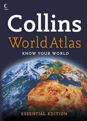
Collins World Atlas
Seiten
2007
|
Essential ed
Collins (Verlag)
978-0-00-724318-1 (ISBN)
Collins (Verlag)
978-0-00-724318-1 (ISBN)
- Titel erscheint in neuer Auflage
- Artikel merken
Zu diesem Artikel existiert eine Nachauflage
Shows the declaration of Montenegro and Serbia as independent countries in the mapping and statistical section. This atlas includes key statistics, facts and flags for every country of the world. With over 25,000 place names, it gives several world ranking tables, including highest mountains, deepest lakes, and largest countries.
This excellent reference atlas at a budget price is a new title for 2007 in the exciting Collins world atlas range. This atlas provides more mapping area than any other atlas at this price. Specially designed presentation of maps in a clear accessible form. This new world atlas contains over 70 pages of highly accurate and up-to-date reference maps are presented in the beautiful full-page Collins map style. The recent declaration of Montenegro and Serbia as independent countries is shown in the mapping and statistical section. Key statistics, facts and flags for ever country of the world are included in the introductory section giving the user quick access to essential facts. These are supplemented by internet links to the most appropriate websites which provide opportunities for the reader to investigate issues further. Several world ranking tables are given, including highest mountains, deepest lakes and largest countries, making this atlas ideal for quizzes and crosswords. With over 50,000 place names, this atlas gives the user a detailed reference map with extensive worldwide coverage at an excellent price.
This excellent reference atlas at a budget price is a new title for 2007 in the exciting Collins world atlas range. This atlas provides more mapping area than any other atlas at this price. Specially designed presentation of maps in a clear accessible form. This new world atlas contains over 70 pages of highly accurate and up-to-date reference maps are presented in the beautiful full-page Collins map style. The recent declaration of Montenegro and Serbia as independent countries is shown in the mapping and statistical section. Key statistics, facts and flags for ever country of the world are included in the introductory section giving the user quick access to essential facts. These are supplemented by internet links to the most appropriate websites which provide opportunities for the reader to investigate issues further. Several world ranking tables are given, including highest mountains, deepest lakes and largest countries, making this atlas ideal for quizzes and crosswords. With over 50,000 place names, this atlas gives the user a detailed reference map with extensive worldwide coverage at an excellent price.
| Erscheint lt. Verlag | 2.4.2007 |
|---|---|
| Zusatzinfo | Illustrations, maps |
| Verlagsort | London |
| Sprache | englisch |
| Maße | 226 x 312 mm |
| Gewicht | 571 g |
| Themenwelt | Reisen ► Karten / Stadtpläne / Atlanten |
| ISBN-10 | 0-00-724318-9 / 0007243189 |
| ISBN-13 | 978-0-00-724318-1 / 9780007243181 |
| Zustand | Neuware |
| Haben Sie eine Frage zum Produkt? |
Mehr entdecken
aus dem Bereich
aus dem Bereich
Buch | Hardcover (2022)
Klett (Verlag)
30,95 €


