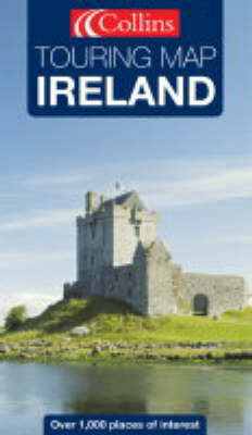
Ireland
2004
|
4th New edition
Collins (Verlag)
978-0-00-717013-5 (ISBN)
Collins (Verlag)
978-0-00-717013-5 (ISBN)
- Titel ist leider vergriffen;
keine Neuauflage - Artikel merken
This is a full colour map with an emphasis on places of tourist interest in addition to a detailed road network. Features include: a handy touring scale of 7.5 miles to 1 inch; over 20 categories of tourist information; a full index to place names and places of interest; and attractive hillshading.
7. 5 miles to 1 inch 1:475,000. Full colour map with a special emphasis on places of tourist interest in addition to a detailed road network. Updated in 2004. MAIN FEATURES; Handy touring scale of 7. 5 miles to 1 inch; Over 20 categories of tourist information; Full index to place names and places of interest; Shape of the landscape shown by attractive hillshadingINCLUDES; All classified and most minor roads; Railway network and ferry routes; Viewpoints and sandy beachesAREA OF COVERAGE Whole of Ireland at 7. 5 miles to 1 inchWHO THE PRODUCT IS OF INTEREST TO Essential for the tourist or holiday maker who requires a route planning map plus tourist features
7. 5 miles to 1 inch 1:475,000. Full colour map with a special emphasis on places of tourist interest in addition to a detailed road network. Updated in 2004. MAIN FEATURES; Handy touring scale of 7. 5 miles to 1 inch; Over 20 categories of tourist information; Full index to place names and places of interest; Shape of the landscape shown by attractive hillshadingINCLUDES; All classified and most minor roads; Railway network and ferry routes; Viewpoints and sandy beachesAREA OF COVERAGE Whole of Ireland at 7. 5 miles to 1 inchWHO THE PRODUCT IS OF INTEREST TO Essential for the tourist or holiday maker who requires a route planning map plus tourist features
| Erscheint lt. Verlag | 4.5.2004 |
|---|---|
| Reihe/Serie | Touring Map S. |
| Zusatzinfo | With index |
| Verlagsort | London |
| Sprache | englisch |
| Maße | 139 x 237 mm |
| Gewicht | 117 g |
| Themenwelt | Reisen ► Karten / Stadtpläne / Atlanten ► Europa |
| ISBN-10 | 0-00-717013-0 / 0007170130 |
| ISBN-13 | 978-0-00-717013-5 / 9780007170135 |
| Zustand | Neuware |
| Haben Sie eine Frage zum Produkt? |
Mehr entdecken
aus dem Bereich
aus dem Bereich
Karte (gefalzt) (2023)
Freytag-Berndt und ARTARIA (Verlag)
12,90 €
Straßen- und Freizeitkarte 1:250.000
Karte (gefalzt) (2023)
Freytag-Berndt und ARTARIA (Verlag)
12,90 €
Narvik
Karte (gefalzt) (2023)
Freytag-Berndt und ARTARIA (Verlag)
12,90 €


