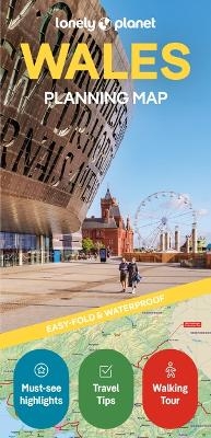
Lonely Planet Wales Planning Map
Seiten
2025
|
2nd edition
Lonely Planet Global Limited (Verlag)
978-1-78868-898-7 (ISBN)
Lonely Planet Global Limited (Verlag)
978-1-78868-898-7 (ISBN)
- Noch nicht erschienen (ca. Juni 2025)
- Versandkostenfrei innerhalb Deutschlands
- Auch auf Rechnung
- Verfügbarkeit in der Filiale vor Ort prüfen
- Artikel merken
Durable and waterproof, with a handy slipcase and an easy-fold format, Lonely Planet’s Wales Planning Map is your essential navigation tool. This full-colour map features accompanying images and information about top attractions, itinerary suggestions, a transport guide, themed lists and practical travel tips.
Durable and waterproof, with a handy slipcase and an easy-fold format, Lonely Planet's Wales Planning Map is your essential navigation tool. This full-colour map features accompanying images and information about top attractions, itinerary suggestions, a transport guide, themed lists and practical travel tips.
Durable and waterproof
Easy-fold format and convenient size
Handy slipcase
Full colour and easy to use
Before-you-go info
Beautiful imagery
Tailored itineraries
Can't-miss regional highlights
Detailed town index
Themed lists
Covers Cardiff, Brecon Beacons, Swansea, the Gower, Carmarthenshire, Pembrokeshire, Aberystwyth, Snowdonia, Anglesey and more
Looking for more extensive coverage? Check out Lonely Planet's Wales, our most comprehensive guidebook to Wales, covering the top sights and most authentic offbeat experiences. Or check out Lonely Planet's Experience Wales, a concise visual guide highlighting the top experiences of Wales.
About Lonely Planet:
Lonely Planet, a Red Ventures Company, is the world's number one travel guidebook brand. Providing both inspiring and trustworthy information for every kind of traveller since 1973, Lonely Planet reaches hundreds of millions of travellers each year online and in print and helps them unlock amazing experiences. Visit us at lonelyplanet.com and join our community of followers on Facebook (facebook.com/lonelyplanet), Twitter (@lonelyplanet), Instagram (instagram.com/lonelyplanet), and TikTok (@lonelyplanet).
'Lonely Planet. It's on everyone's bookshelves; it's in every traveller's hands. It's on mobile phones. It's on the Internet. It's everywhere, and it's telling entire generations of people how to travel the world.' Fairfax Media (Australia)
| Erscheint lt. Verlag | 12.6.2025 |
|---|---|
| Reihe/Serie | Map |
| Zusatzinfo | 1 Maps |
| Verlagsort | Dublin 8 |
| Sprache | englisch |
| Maße | 95 x 197 mm |
| Gewicht | 38 g |
| Themenwelt | Reisen ► Karten / Stadtpläne / Atlanten ► Europa |
| Reiseführer ► Europa ► Großbritannien | |
| Naturwissenschaften ► Geowissenschaften ► Geografie / Kartografie | |
| ISBN-10 | 1-78868-898-8 / 1788688988 |
| ISBN-13 | 978-1-78868-898-7 / 9781788688987 |
| Zustand | Neuware |
| Informationen gemäß Produktsicherheitsverordnung (GPSR) | |
| Haben Sie eine Frage zum Produkt? |
Mehr entdecken
aus dem Bereich
aus dem Bereich
Explore Scotland’s Ancient Monuments
Karte (gefalzt) (2024)
Collins (Verlag)
9,95 €


