


Paris
Destination City Maps
Seiten
2012
National Geographic Maps (Verlag)
978-1-59775-028-8 (ISBN)
National Geographic Maps (Verlag)
978-1-59775-028-8 (ISBN)
- Titel erscheint in neuer Auflage
- Artikel merken
Zu diesem Artikel existiert eine Nachauflage
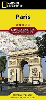
CityDestinationMaps blend urban guidebook information with easy to read street maps, complete with 3D buildings. The maps are printed on waterproof, tear-resistant material that's lightweight yet very durable - idea for travel. In addition to the easy-to-read map on the front, the back of this Paris map includes: Regional map; Points of interest; Airport diagrams for Paris-Charles de Gaulle and Paris-Orly airports; Inset map of La Defense; Metro map; and a Multi-language legend.
Founded in 1915 as the Cartographic Group, the first division of the National Geographic Society, National Geographic Maps has been responsible for illustrating the world around us through the art and science of mapmaking. Today, National Geographic Maps continues this mission by creating the world's best wall maps, recreation maps, atlases, and globes which inspire people to care about and explore their world. All proceeds from the sale of National Geographic maps go to support the Society's non-profit mission to increase global understanding and promote conservation of our planet through exploration, research, and education.
| Erscheint lt. Verlag | 2.8.2012 |
|---|---|
| Reihe/Serie | National Geographic DestinationMaps |
| Verlagsort | Evergreen |
| Sprache | englisch |
| Maße | 105 x 225 mm |
| Gewicht | 42 g |
| Einbandart | gefalzt |
| Themenwelt | Reisen ► Karten / Stadtpläne / Atlanten ► Europa |
| ISBN-10 | 1-59775-028-X / 159775028X |
| ISBN-13 | 978-1-59775-028-8 / 9781597750288 |
| Zustand | Neuware |
| Informationen gemäß Produktsicherheitsverordnung (GPSR) | |
| Haben Sie eine Frage zum Produkt? |
Mehr entdecken
aus dem Bereich


aus dem Bereich
Straßen- und Freizeitkarte 1:250.000
Karte (gefalzt) (2023)
Freytag-Berndt und ARTARIA (Verlag)
12,90 €
Narvik
Karte (gefalzt) (2023)
Freytag-Berndt und ARTARIA (Verlag)
12,90 €
Karte (gefalzt) (2023)
Freytag-Berndt und ARTARIA (Verlag)
12,90 €