


Touring Map of Kruger National Park
Blyde River Canyon, Polokwane and Nelspruit
2005
Sunbird Publishers Ltd (Verlag)
978-1-919938-33-2 (ISBN)
Sunbird Publishers Ltd (Verlag)
978-1-919938-33-2 (ISBN)
- Titel ist leider vergriffen;
keine Neuauflage - Artikel merken
Features a double-sided folding map of the Kruger National Park. As you open the map you find the open and closing times of the camps and park gates. Unfolding the map further shows the key to the symbols plus the scale and a location map helping to plan your route to the park from the Gauteng province.
This title features a double-sided folding map of the Kruger National Park (unfolding to 969 x 700mm). As you open the map you will find the open and closing times of the camps and park gates. Unfolding the map further shows the key to the symbols plus the scale and a location map helping to plan your route to the park from the Gauteng province. The map then unfolds fully to reveal the Southern half of the Kruger National Park at 1: 250 000 in detail and shows vegetation, which can be referred to when using the guide information for trees, mammals and birds at the bottom of the map. There is a list of mammals that inhabit the park, 19 photographs of birds, mammals and scenery plus layout plans of nine camps from Crocodile Bridge north to Olifants. On the reverse there is a detailed map of the Northern half of the Kruger National Park at 1:250 000, plus 30 photographs, four camp layouts (Letaba to Punda Maria) and a list of birds found in the park. There is also guide information for trees, mammals and birds in the north, town plans of Nelspruit and Polokwane (Pietersburg) and a map of the Blyderivierspoort Nature Reserve for those touring outside of the park.
The inside front cover has a distance chart in colour showing the distance between gates, camps, bushveld camps and picnic areas, together with average road speeds on tarred and dirt roads, which makes it easy to estimate the time taken to drive between points. In short, all you need for your next trip to the Kruger.
| Erscheint lt. Verlag | 15.9.2005 |
|---|---|
| Verlagsort | Cape Town |
| Sprache | englisch |
| Maße | 140 x 235 mm |
| Themenwelt | Reisen ► Karten / Stadtpläne / Atlanten ► Afrika |
| ISBN-10 | 1-919938-33-8 / 1919938338 |
| ISBN-13 | 978-1-919938-33-2 / 9781919938332 |
| Zustand | Neuware |
| Haben Sie eine Frage zum Produkt? |
Mehr entdecken
aus dem Bereich
aus dem Bereich
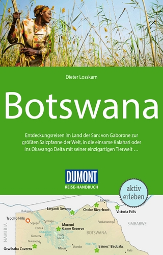
Entdeckungsreisen im Land der San: von Gaborone zur größten …
Buch | Softcover (2024)
DuMont Reiseverlag
24,95 €