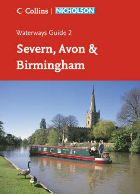
Severn, Avon and Birmingham
Seiten
2006
|
New A5 edition
Nicholson (Verlag)
978-0-00-721110-4 (ISBN)
Nicholson (Verlag)
978-0-00-721110-4 (ISBN)
- Titel erscheint in neuer Auflage
- Artikel merken
Zu diesem Artikel existiert eine Nachauflage
Colour maps clearly showing locks, towpaths and boating facilities as well as comprehensive navigational notes.
First published in the 1970s, the Collins/Nicholson guides to the waterways are designed for anyone and everyone with an interest in Britain’s inland waterways – experienced boaters and those planning their first boat trip, walkers, cyclists and visitors.
Maps show:
• locks, bridges, tunnels, aqueducts, winding holes and the towpath;
• waterpoints, sanitary stations, pump out facilities and refuse disposal;
• boatyards, pubs, restaurants and shops;
• mile markers and milestones (distance in miles and number of locks to strategic points along the waterways).
Text includes:
• the history of each canal; local services and places of interest, pubs and restaurants;
• opportunities for walking and cycling.
Comprehensive navigational notes include:
• maximum dimensions and low bridges;
• mileages, advice and potential hazards;
• navigation authorities and contact details.
Waterways covered in this guide – River Avon, Birmingham Canal Navigations (Main Line), Droitwich Canal, Gloucester & Sharpness Canal and the River Severn, Staffordshire & Worcestershire Canal, Stourbridge and Dudley Canals, Stratford-on-Avon Canal, Worcester & Birmingham Canal.
| Erscheint lt. Verlag | 6.3.2006 |
|---|---|
| Reihe/Serie | Collins/Nicholson Waterways Guides ; Book 2 |
| Verlagsort | Edinburgh |
| Sprache | englisch |
| Maße | 148 x 210 mm |
| Gewicht | 286 g |
| Themenwelt | Natur / Technik ► Fahrzeuge / Flugzeuge / Schiffe ► Schiffe |
| Reisen ► Karten / Stadtpläne / Atlanten ► Europa | |
| ISBN-10 | 0-00-721110-4 / 0007211104 |
| ISBN-13 | 978-0-00-721110-4 / 9780007211104 |
| Zustand | Neuware |
| Informationen gemäß Produktsicherheitsverordnung (GPSR) | |
| Haben Sie eine Frage zum Produkt? |
Mehr entdecken
aus dem Bereich
aus dem Bereich
internationales Jahrbuch der Seefahrt
Buch | Softcover (2024)
Koehler in Maximilian Verlag GmbH & Co. KG
23,95 €


