Reivers Way
Cicerone Press (Verlag)
978-1-85284-130-0 (ISBN)
- Titel ist leider vergriffen;
keine Neuauflage - Artikel merken
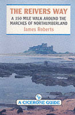
The Reivers Way runs 150 miles through some of the finest landscapes in Northumberland. It starts at Corbridge station, on the main Newcastle to Carlisle railway line, and finishes at Alnmouth station, on the Edinburgh to London main line. It can be walked in nine day-stages, staying in bed and breakfasts, or camping if you prefer. There are also a number of pubs and hotels to stay in en route. It takes in some of the most delightful small towns and villages in the county - Corbridge, Alnwick, Rothbury, Wooler, Holystone, Craster and many more. It finishes by walking the finest stretch of "Northumbria's lordly strand", from Budle Bay to the mouth of the Aln. The terrain walked includes high moorland of the Cheviots and the Allendale Moors as well as some fine wooded denes around the tributaries of the upper Tyne and the best stretch of Hadrian's Wall from Housesteads to Sewingshields. It passes, or rather pauses, in a number of delightful pubs along the way. This guide directs the walker along the way and explains much of the historical background to the region.
James Roberts finished work on his guide to Romania just before his untimely death in 2002. Since the revolution he had spent more than half of every year in Romania and had travelled throughout the country. An experienced solo backpacker here, as well as in the Himalaya, the Atlas and other areas, he worked as a leader of mountain-walking and wildlife groups. Married to Elena, a Romanian, James spoke the language and had an unrivalled knowledge of the country, having explored every massif solo on foot. With his detailed knowledge of the human and natural history of the country, he was an expert interpreter of the Romanian scene.
INTRODUCTION CHAPTER: Corbridge station to Allendale (17miles) Allendale to Bardon Mill (11miles) Bardon Mill to Wark (13miles) Wark to Elsdon (18miles) Elsdon to Rothbury (13miles) Rothbury to Uswayford (18miles) Uswayford to Wooler (18miles) Wooler to Bamburgh (18miles) Bamburgh to Almouth station (19miles) Appendix- Accommodation Bibliography List of useful Ordnance Survey Maps
| Erscheint lt. Verlag | 1.1.1993 |
|---|---|
| Zusatzinfo | Laminated Cover |
| Verlagsort | Kendal |
| Sprache | englisch |
| Maße | 116 x 172 mm |
| Themenwelt | Sachbuch/Ratgeber ► Sport |
| Reiseführer ► Europa ► Großbritannien | |
| ISBN-10 | 1-85284-130-3 / 1852841303 |
| ISBN-13 | 978-1-85284-130-0 / 9781852841300 |
| Zustand | Neuware |
| Haben Sie eine Frage zum Produkt? |
aus dem Bereich


