


Collins USA Road Map
2005
Collins (Verlag)
978-0-00-720680-3 (ISBN)
Collins (Verlag)
978-0-00-720680-3 (ISBN)
- Titel ist leider vergriffen;
keine Neuauflage - Artikel merken
Zu diesem Artikel existiert eine Nachauflage
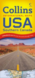
New politically coloured road map of all of the USA. The ideal map for planning and route-finding.
Scale 1:5 000 000 (1 cm to 50 kms/1 inch to 80 miles)
MAIN FEATURES
Detailed route planning map with classified road network featuring individual states depicted in attractive political colouring.
AREA OF COVERAGE
All of USA extending from the Atlantic coast to the Pacific coast and from the Canadian border in the north to Mexico and the Caribbean in the south. Includes inset maps of Alaska, Hawaii and Puerto Rico.
INCLUDES
Useful features include detailed city maps of New York, Washington, Boston, San Francisco, Los Angeles, New Orleans, Seattle, Miami, Denver, Las Vegas and Chicago, and distance chart.
• Comprehensive place name index to cities and towns on reverse of sheet
• Driving information, time zones and internet links to further information complete the content of the map sheet.
WHO THE PRODUCT IS AIMED AT
The ideal map for the traveller for both planning and using on a trip. Also useful for home and business reference.
OTHER PRODUCTS IN THE SERIES
2006 Map of Europe
2006 Map of France
2006 Map of Spain & Portugal
2006 Map of Britain
2006 Map of Scotland
2006 Map of Ireland
| Erscheint lt. Verlag | 3.10.2005 |
|---|---|
| Zusatzinfo | Index |
| Verlagsort | London |
| Sprache | englisch |
| Maße | 140 x 250 mm |
| Gewicht | 125 g |
| Themenwelt | Reisen ► Karten / Stadtpläne / Atlanten ► Nord- / Mittelamerika |
| ISBN-10 | 0-00-720680-1 / 0007206801 |
| ISBN-13 | 978-0-00-720680-3 / 9780007206803 |
| Zustand | Neuware |
| Haben Sie eine Frage zum Produkt? |
Mehr entdecken
aus dem Bereich


aus dem Bereich
Karte (gefalzt) (2024)
Freytag-Berndt und ARTARIA (Verlag)
12,90 €
Karte (gefalzt) (2023)
Reise Know-How (Verlag)
12,00 €
Karte (gefalzt) (2023)
Reise Know-How (Verlag)
12,00 €