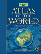
Philip's Atlas of the World
Seiten
2005
|
Comprehensive new ed
Philip's (Verlag)
978-0-540-08743-3 (ISBN)
Philip's (Verlag)
978-0-540-08743-3 (ISBN)
- Titel erscheint in neuer Auflage
- Artikel merken
Zu diesem Artikel existiert eine Nachauflage
Features 176 pages of detailed maps that describe the political developments and name and border changes. The combination of relief colouring and hill-shading gives an interesting portrayal of landforms.
Philip's World Reference Atlas is a highly-informative atlas suitable for school projects, home reference and general knowledge. Along with 128 pages of authoritative topographic mapping, the atlas provides a wealth of detailed reference information, including 8 pages of world statistical data, 'Regions in the News', a 48-page A-Z of sovereign states, illustrated with flags and locator maps, and a 16-page 'Images of Earth' section, showing spectacular satellite views across the globe. The world statistics section provides comparative listings of country sizes, city populations and dimensions of geographical features, such as oceans, seas, mountains, rivers, lakes and islands, for each continent. 'Regions in the News' are covered with detailed maps of global flashpoints: Iraq, Israel and the South-east Asia tsunami. The 48-page 'Nations of the World' section provides detailed information about the geography, politics and economy of every sovereign state, together with listings showing population statistics, land area, ethnic groups and languages. Each entry is illustrated with the country's flag and a locator map.The 16-page 'Images of Earth' shows stunning satellite views of 40 fascinating geographical locations and features from around the world, accompanied by explanatory captions.
The 128 pages of physical and political maps provide a balanced coverage of the world. Scales and projections have been chosen to maximize legibility and minimize distortion over the largest regions, and each map is accompanied by a locator diagram and adjoining pages indicator for ease of reference. The combination of hill-shading with physical colours creates an exceptionally vivid impression of the Earth's terrain. The extensive alpha-numeric index of 55,000 names includes geographical features such as mountains, rivers, lakes and deserts, as well as provinces, towns and cities.
| Erscheint lt. Verlag | 17.10.2005 |
|---|---|
| Reihe/Serie | Philip's World Atlases |
| Zusatzinfo | 176digital physical mapping, 40'city maps', 48geographical information, 32gazetter, 16satellite imagery |
| Verlagsort | London |
| Sprache | englisch |
| Maße | 290 x 378 mm |
| Gewicht | 3445 g |
| Themenwelt | Reisen ► Karten / Stadtpläne / Atlanten |
| ISBN-10 | 0-540-08743-2 / 0540087432 |
| ISBN-13 | 978-0-540-08743-3 / 9780540087433 |
| Zustand | Neuware |
| Informationen gemäß Produktsicherheitsverordnung (GPSR) | |
| Haben Sie eine Frage zum Produkt? |
Mehr entdecken
aus dem Bereich
aus dem Bereich
Buch | Hardcover (2022)
Klett (Verlag)
31,95 €


