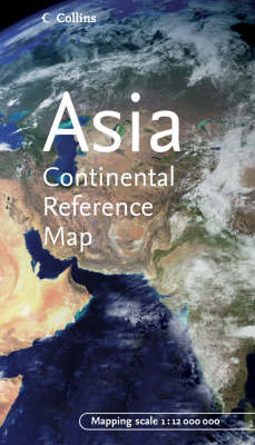
Asia
2005
|
New edition
Collins (Verlag)
978-0-00-720414-4 (ISBN)
Collins (Verlag)
978-0-00-720414-4 (ISBN)
- Titel ist leider vergriffen;
keine Neuauflage - Artikel merken
An expanded edition covering all of Asia and giving an overview of the physical make up, road and rail network and political units of the continent. Includes facts, figures and internet links. Scale 1:12 000 000; 1 cm to 120 km; 1 inch to 190 miles.
A new, expanded edition covering all of Asia and giving an overview of the physical make up, road and rail network and political units of the continent. Includes facts, figures and internet links. Scale 1:12 000 000; 1 cm to 120 km; 1 inch to 190 miles. MAIN FEATURES Physical map with attractive layer colouring and including roads, railways, cities and towns. AREA OF COVERAGE From the Arctic Ocean to Indonesia and from Europe to the Pacific Ocean. INCLUDES Comprehensive place names index on reverse of the sheet expanded to include gazetteer-style entries for important features. Also contains facts about the continent, statistics, and internet links to other sources of information. WHO THE PRODUCT IS AIMED AT Armchair traveller, general reference and educational use. OTHER PRODUCTS IN THE CONTINENTAL MAP SERIES Africa Europe North America South America
A new, expanded edition covering all of Asia and giving an overview of the physical make up, road and rail network and political units of the continent. Includes facts, figures and internet links. Scale 1:12 000 000; 1 cm to 120 km; 1 inch to 190 miles. MAIN FEATURES Physical map with attractive layer colouring and including roads, railways, cities and towns. AREA OF COVERAGE From the Arctic Ocean to Indonesia and from Europe to the Pacific Ocean. INCLUDES Comprehensive place names index on reverse of the sheet expanded to include gazetteer-style entries for important features. Also contains facts about the continent, statistics, and internet links to other sources of information. WHO THE PRODUCT IS AIMED AT Armchair traveller, general reference and educational use. OTHER PRODUCTS IN THE CONTINENTAL MAP SERIES Africa Europe North America South America
| Erscheint lt. Verlag | 6.6.2005 |
|---|---|
| Reihe/Serie | Continental Map S. |
| Zusatzinfo | With index |
| Verlagsort | London |
| Sprache | englisch |
| Maße | 115 x 257 mm |
| Gewicht | 117 g |
| Themenwelt | Reisen ► Karten / Stadtpläne / Atlanten ► Asien |
| ISBN-10 | 0-00-720414-0 / 0007204140 |
| ISBN-13 | 978-0-00-720414-4 / 9780007204144 |
| Zustand | Neuware |
| Haben Sie eine Frage zum Produkt? |
Mehr entdecken
aus dem Bereich
aus dem Bereich
Karte (gefalzt) (2024)
Freytag-Berndt und ARTARIA (Verlag)
12,90 €
Karte (gefalzt) (2023)
Reise Know-How (Verlag)
14,00 €
reiß- und wasserfest (world mapping project)
Karte (gefalzt) (2024)
Reise Know-How (Verlag)
12,00 €


