Gravel Rides Lake District
Vertebrate Publishing Ltd (Verlag)
978-1-83981-184-5 (ISBN)
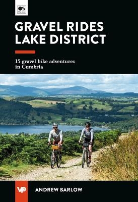
Gravel Rides Lake District showcases 15 of the best gravel bike rides in the stunning Lake District National Park. From 17 to 270 kilometres in length and covering a variety of terrain, there is something for every gravel cyclist.
Explore the Windermere shoreline, traverse the meandering gravel of Claife Heights, and enjoy the views and feeling of isolation on the bleak open moorland of Askham Fell and while following the peaceful Borrow Beck.
Researched, ridden and written by Lakes local Andrew Barlow, the routes feature clear and easy-to-use Ordnance Survey maps; easy-to-follow directions; details of distance, timings and difficulty gradings; stunning action photography; refreshment stops and local knowledge; and a detailed Appendix. Also included is a link to downloadable GPX files.
Andrew Barlow grew up in a Cheshire farming family, so the outdoor lifestyle was distilled within him from a very young age. Now Andrew is a freelance storyteller within the outdoor industry and is an advocate for inclusive cycling. He started enjoying hiking and landscape photography while living in Manchester, often escaping the stresses of his corporate printing job to enjoy the golden triangle of national parks nearby – the Peak District, Lake District and Eryri (Snowdonia). Andrew relocated to Cumbria in 2018 after quitting the rat race to slow down and enjoy his photography. He then rekindled his love for cycling by using his bike as a tool to explore the lanes, bridleways and cycle routes of Cumbria, rather than to commute to work within the city. This led to his first book – Gravel Rides Lake District – which was written with an inclusive ethos in mind, so everyone can enjoy cycling as much as he does. @andrewbarlowphoto
Gravel Rides Lake District Area Map & Route Finder
Introduction
Acknowledgements
How to use this book
Rights of way
Bikepacking
The bike
Recommended kit list
General safety
In the event of an accident
Rules of the (off) road
Planning your ride
Maps & symbols
Section 1 – Easy routes
1 Force Crag Mine & the Coledale Valley
2 Blawith Common
3 Loughrigg loop
4 Ambleside, Hawkshead & Claife Heights
Section 2 – Medium routes
5 St John’s in the Vale & Keswick Railway Path
6 Askham Fell
7 Glenderaterra
8 Keswick & the Newlands Valley
9 Tilberthwaite & Langdale
10 Grizedale Forest
11 Staveley to shoreside
Section 3 – Hard routes
12 Kentmere
13 The other Borrowdale
14 Skiddaw House & the Old Coach Road
15 Lakeland 270
Appendix
| Erscheinungsdatum | 05.03.2024 |
|---|---|
| Reihe/Serie | UK Gravel Rides |
| Zusatzinfo | Halftones, color; Ordnance Survey 1:50,000-scale maps |
| Sprache | englisch |
| Maße | 120 x 175 mm |
| Gewicht | 250 g |
| Themenwelt | Sachbuch/Ratgeber ► Sport ► Motor- / Rad- / Flugsport |
| Reiseführer ► Europa ► Großbritannien | |
| ISBN-10 | 1-83981-184-6 / 1839811846 |
| ISBN-13 | 978-1-83981-184-5 / 9781839811845 |
| Zustand | Neuware |
| Informationen gemäß Produktsicherheitsverordnung (GPSR) | |
| Haben Sie eine Frage zum Produkt? |
aus dem Bereich


