The Pembrokeshire Coast Path
Cicerone Press (Verlag)
978-1-78631-208-2 (ISBN)
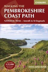
A guidebook to walking the Pembrokeshire Coast Path National Trail between Amroth near Tenby and St Dogmaels by Cardigan. Covering 290km (180 miles) and over 10,500m of ascent, this trail takes around 2 weeks to hike.
The route is described from south to north in 14 stages between 15 and 27km (9-17 miles) in length. An abbreviated route description is also given for those walking the route north to south, as well as alternate routes to avoid high tide and military range closures.
Contains step-by-step description of the route alongside 1:100,000 OS maps
Includes a separate map booklet containing OS 1:25,000 mapping and route line
The book features a handy trek planner that highlights information about accommodation, facilities and public transport along the route
Sized to easily fit in a jacket pocket
Dennis and Jan Kelsall published their first Cicerone title in 1995 and have since written around 35 guides to some of Britain's most popular walking areas: they have also become regular contributors to various outdoor magazines. Their enjoyment of the countryside extends far beyond a love of fresh air, open spaces and scenery: over the years Dennis and Jan have developed wider interests in the environment, geology and wildlife, as well as an enthusiasm for local history, which so often provides clues to interpreting the landscape.
Route summary table
Overview map and profile
Map key
Trek planner
Introduction
Planning your trip
Which way to walk
How long will it take?
Not enough time to do it all?
Detours to avoid high tide
Military ranges
When to walk
Getting there and back
Accommodation
Transport along the route
Facilities en route
Things to do before and after the walk
Walking holidays and baggage transfer
Passports, visas and currency
What to take
Planning day by day
Using this guide
Mapping and GPS
Weather forecasts
Finding your way
Health, safety and emergencies
Taking your dog
Communications
Language
All about Pembrokeshire
The Pembrokeshire Coast Path
A geological overview
Man in the landscape
Plants and wildlife
The Pembrokeshire Coast Path
Stage 1 Amroth to Skrinkle Haven
Stage 2 Skrinkle Haven to Broad Haven
Stage 3 Broad Haven to West Angle
Stage 4 West Angle to Pembroke
Stage 5 Pembroke to Sandy Haven
Stage 6 Sandy Haven to Westdale Bay
Stage 7 Westdale Bay to Little Haven
Stage 8 Little Haven to Solva
Stage 9 Solva to Whitesands Bay
Stage 10 Whitesands Bay to Aber Draw
Stage 11 Aber Draw to Pwll Deri
Stage 12 Pwll Deri to Goodwick Sands
Stage 13 Goodwick Sands to Newport Parrog
Stage 14 Newport Parrog to St Dogmaels
Appendix A Useful contacts
Appendix B Accommodation along the route
Appendix C Grid refs for PCP access points
Appendix D Glossary of Welsh place names
0
0
2016-01-08T12:26:00Z
1
205
1172
Cicerone Press
9
2
1375
14.0
Normal
0
false
false
false
EN-GB
JA
X-NONE
/* Style Definitions */
table.MsoNormalTable
{mso-style-name:"Table Normal";
mso-tstyle-rowband-size:0;
mso-tstyle-colband-size:0;
mso-style-noshow:yes;
mso-style-priority:99;
mso-style-parent:"";
mso-padding-alt:0cm 5.4pt 0cm 5.4pt;
mso-para-margin:0cm;
mso-para-margin-bottom:.0001pt;
mso-pagination:widow-orphan;
font-size:12.0pt;
font-family:Cambria;
mso-ascii-font-family:Cambria;
mso-ascii-theme-font:minor-latin;
mso-hansi-font-family:Cambria;
mso-hansi-theme-font:minor-latin;}
| Erscheinungsdatum | 01.03.2024 |
|---|---|
| Reihe/Serie | Cicerone guidebooks |
| Zusatzinfo | 85 colour photographs 28 maps |
| Verlagsort | Kendal |
| Sprache | englisch |
| Maße | 116 x 172 mm |
| Gewicht | 410 g |
| Themenwelt | Sachbuch/Ratgeber ► Sport |
| Reisen ► Sport- / Aktivreisen ► Europa | |
| ISBN-10 | 1-78631-208-5 / 1786312085 |
| ISBN-13 | 978-1-78631-208-2 / 9781786312082 |
| Zustand | Neuware |
| Informationen gemäß Produktsicherheitsverordnung (GPSR) | |
| Haben Sie eine Frage zum Produkt? |
aus dem Bereich