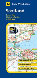
Scotland
2005
|
2nd Revised edition
Automobile Association (Verlag)
978-0-7495-4392-1 (ISBN)
Automobile Association (Verlag)
978-0-7495-4392-1 (ISBN)
- Titel erscheint in neuer Auflage
- Artikel merken
Zu diesem Artikel existiert eine Nachauflage
From the experts at the AA this series of fully updated road maps are all you need for motoring around Britain. The maps combine clear design and more road detail with an easy to read scale to ensure that you never lose your way. New to these editions is a large sheet map covering the whole of the West Country and South Wales, stretching from Bristol, Bath, Swansea and Pool to Land's End and Lizard Point. There are also fifteen town plans on the reverse of each map plus an easy to read place-name index. The maps are folded to a handy slim line format and are contained in a durable encapsulated card cover, offering great value for this price.
| Erscheint lt. Verlag | 28.2.2005 |
|---|---|
| Reihe/Serie | AA Road Map Britain ; No. 9 |
| Verlagsort | Basingstoke |
| Sprache | englisch |
| Maße | 118 x 251 mm |
| Gewicht | 130 g |
| Themenwelt | Reisen ► Hotel- / Restaurantführer ► Europa |
| Reisen ► Karten / Stadtpläne / Atlanten ► Europa | |
| Reiseführer ► Europa ► Großbritannien | |
| ISBN-10 | 0-7495-4392-2 / 0749543922 |
| ISBN-13 | 978-0-7495-4392-1 / 9780749543921 |
| Zustand | Neuware |
| Haben Sie eine Frage zum Produkt? |
Mehr entdecken
aus dem Bereich
aus dem Bereich
Explore Scotland’s Ancient Monuments
Karte (gefalzt) (2024)
Collins (Verlag)
9,95 €
