


Philip's Africa Reference Map (Political)
Seiten
2004
Philip's (Verlag)
978-0-540-08605-4 (ISBN)
Philip's (Verlag)
978-0-540-08605-4 (ISBN)
- Titel ist leider vergriffen;
keine Neuauflage - Artikel merken
New for 2004, this brightly coloured wall chart shows the whole of Africa in political coloration, with clear lettering and symbols for easy reference. Countries are picked out in distinctive colours to aid identification, with town and city names clearly shown. Accompanying the main map is a separate smaller-scale inset map showing the continent in physical colours, together with colourful thematic maps showing the official languages across Africa, as well as the countries making up the Arab League and the Southern African Development Community (SADC). Philip's Africa Reference Map (Political) is supplied in two versions: (a) laminated on both sides and rolled into a clear plastic tube for use as a wall map; and (b) unlaminated and folded with a tipped-on card cover for use when travelling
| Erscheint lt. Verlag | 15.11.2004 |
|---|---|
| Reihe/Serie | Philip's Wall Maps |
| Verlagsort | London |
| Sprache | englisch |
| Maße | 2 x 2 mm |
| Gewicht | 300 g |
| Themenwelt | Reisen ► Karten / Stadtpläne / Atlanten ► Afrika |
| ISBN-10 | 0-540-08605-3 / 0540086053 |
| ISBN-13 | 978-0-540-08605-4 / 9780540086054 |
| Zustand | Neuware |
| Informationen gemäß Produktsicherheitsverordnung (GPSR) | |
| Haben Sie eine Frage zum Produkt? |
Mehr entdecken
aus dem Bereich
aus dem Bereich
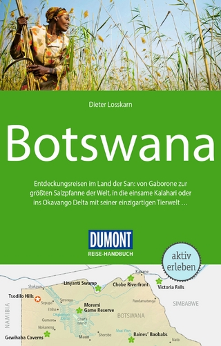
Entdeckungsreisen im Land der San: von Gaborone zur größten …
Buch | Softcover (2024)
DuMont Reiseverlag
24,95 €