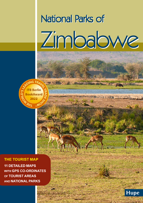
National Parks of Zimbabwe
GPS-taugliche Nationalparkkarten mit GPS-Koordinaten
2022
|
2. aktualisierte Auflage 2022
Hupe, I (Verlag)
978-3-932084-96-6 (ISBN)
Hupe, I (Verlag)
978-3-932084-96-6 (ISBN)
Elf aktuelle detaillierte Karten der bedeutendsten Nationalparks von Zimbabwe, zweisprachig englisch/deutsch mit zahlreichen GPS-Koordinaten: Zambezi NP, Mana Pools NP, Hwange NP, Gonarezhou NP, Matusadona NP, Chizarira NP, Nyanga NP, Matobo NP, Kazuma Pan NP, Kyle Recreational Park, Kariba Recreational AreaThis new Zimbabwe Map is the first and most accurate and comprehensive map for the National Parks of Zimbabwe, including GPS-co-ordinates. Covering the touristic road network of Zimbabwe with detailed, most accurate and comprehensive maps of the most important national parks in Zimbabwe.
Manfred Vachal hat sich in den letzten 28 Jahren einen hervorragenden Ruf für Afrika-Reiseliteratur und Kartographie erarbeitet. Manfred Vachal has earned an excellent reputation for African travel literature and cartography over the past 28 years.
| Erscheint lt. Verlag | 14.9.2022 |
|---|---|
| Mitarbeit |
Berater: Ilona Hupe |
| Zusatzinfo | Doppelseitige Landkarte gefaltet auf Din A5 / 32 Seiten mit 11 Detailkarten für die Nationalparks in Zimbabwe |
| Sprache | englisch; deutsch |
| Maße | 590 x 840 mm |
| Gewicht | 70 g |
| Einbandart | gefalzt |
| Themenwelt | Reisen ► Karten / Stadtpläne / Atlanten ► Afrika |
| Schlagworte | Afrika • Chizarira National Park • Eastern Highlands • Gonarezhou • GPS-coordinates • Hupe, Ilona • Hwange National Park • Kariba • Kazuma Pan • Lake Kyle Muturikwa • Mana Pools • Matobo • Matusadona • Matusadonha • Nationalparks • Nyanga • Safari • Self Drive Offroad GPS • Simbabwe • Tourist-Map • Travel map • Vachal, Manfred • Victoria Falls • Zambezi Valley • Zimbabwe |
| ISBN-10 | 3-932084-96-9 / 3932084969 |
| ISBN-13 | 978-3-932084-96-6 / 9783932084966 |
| Zustand | Neuware |
| Informationen gemäß Produktsicherheitsverordnung (GPSR) | |
| Haben Sie eine Frage zum Produkt? |
Mehr entdecken
aus dem Bereich
aus dem Bereich
Karte (gefalzt) (2024)
Freytag-Berndt und ARTARIA (Verlag)
12,90 €
reiß- und wasserfest (world mapping project)
Karte (gefalzt) (2024)
Reise Know-How Peter Rump GmbH (Verlag)
14,00 €
Karte (gefalzt) (2023)
Freytag-Berndt und ARTARIA (Verlag)
12,90 €


