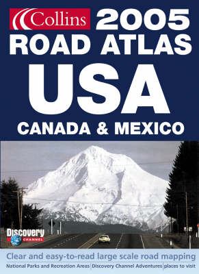
Collins Road Atlas USA, Canada and Mexico
Seiten
2004
|
Revised edition
Collins (Verlag)
978-0-00-719402-5 (ISBN)
Collins (Verlag)
978-0-00-719402-5 (ISBN)
- Titel wird leider nicht erscheinen
- Artikel merken
This is the Collins edition of the American Map Corporation's 'Road Atlas USA, Canada and Mexico'. It is fully up-to-date for 2005 with state-by-state road map coverage, city maps and Discovery Channel side trips. Scales vary with state coverage.
Collins edition of American Map Corporation's successful Road Atlas USA, Canada and Mexico. Fully up-to-date for 2005 with state by state road map coverage, city maps and Discovery Channel sidetrips. Scale varies with state coverage. AREA OF COVERAGE All of North America -- United States, Canada, Mexico. From Alaska to the Gulf of Mexico, and from California to New York. Also includes Hawaii and Puerto Rico. MAIN FEATURES Fully up-to-date road mapping,tourist information. State-by-state mapping. U S National Parks maps. City and urban area maps. Discovery Channel suggested sidetrips to places to visit and unusual destinations. INCLUDES Fully classified road network, state-by-state indexes to place names, road signs, route planning map and State Fairs calendar. WHO THE PRODUCT IS AIMED AT Armchair traveller and anyone planning a trip to North America. OTHER PRODUCTS IN THE SERIES Collins Road Atlas Britain Collins Road Atlas Europe Collins Road Atlas France Collins Road Atlas Italy Collins Road Atlas Spain & Portugal
Collins edition of American Map Corporation's successful Road Atlas USA, Canada and Mexico. Fully up-to-date for 2005 with state by state road map coverage, city maps and Discovery Channel sidetrips. Scale varies with state coverage. AREA OF COVERAGE All of North America -- United States, Canada, Mexico. From Alaska to the Gulf of Mexico, and from California to New York. Also includes Hawaii and Puerto Rico. MAIN FEATURES Fully up-to-date road mapping,tourist information. State-by-state mapping. U S National Parks maps. City and urban area maps. Discovery Channel suggested sidetrips to places to visit and unusual destinations. INCLUDES Fully classified road network, state-by-state indexes to place names, road signs, route planning map and State Fairs calendar. WHO THE PRODUCT IS AIMED AT Armchair traveller and anyone planning a trip to North America. OTHER PRODUCTS IN THE SERIES Collins Road Atlas Britain Collins Road Atlas Europe Collins Road Atlas France Collins Road Atlas Italy Collins Road Atlas Spain & Portugal
| Erscheint lt. Verlag | 4.10.2004 |
|---|---|
| Reihe/Serie | International Road Atlases |
| Zusatzinfo | chiefly col. maps |
| Verlagsort | London |
| Sprache | englisch |
| Maße | 280 x 380 mm |
| Themenwelt | Reisen ► Karten / Stadtpläne / Atlanten ► Nord- / Mittelamerika |
| ISBN-10 | 0-00-719402-1 / 0007194021 |
| ISBN-13 | 978-0-00-719402-5 / 9780007194025 |
| Zustand | Neuware |
| Haben Sie eine Frage zum Produkt? |