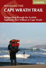
Walking the Cape Wrath Trail
Cicerone Press (Verlag)
978-1-78631-134-4 (ISBN)
A guidebook to walking the 370km (230 mile) Cape Wrath Trail between Fort William and Cape Wrath. This long-distance trek through the Scottish Highlands is suitable for experienced backpackers as it is often regarded as the toughest-long distance route in Britain.
The route is described from south to north in 14 stages, ranging in distance between 13 and 45 kms (8-28 miles). Six alternate stages are also detailed to give a flexible itinerary of between two and three weeks.
Elevation graphs included, and 1:50,000 OS maps for each stage
Highlights include Glenfinnan monument and viaduct, Knoydart, Barisdale, Forcan ridge, Falls of Glomach, Beinn Eighe, Lochan Fada, Shenavall, An Teallach, Glen Douchary, Glen Oykel, Ben More, Glencoul, Arkle, Foinaven, Sandwood Bay
Detailed information on accommodation and resupply opportunities provided
Safety, packing and preparation advice
Compactly-sized to fit in a jacket pocket
Iain Harper completed the Cape Wrath Trail in 2009. Armed with his research he approached Cicerone to write the definitive guidebook to the trek. Iain has walked extensively in the Highlands for 20 years, enjoys running ultra marathons and lives with his wife Kay in the Cotswolds.
Map key
Overview map
Preface
Introduction
Geology and wildlife
Getting there
Getting around
When to go
Accommodation
Safety
Emergencies
Money and communications
Preparation and planning
What to take
Waywarking and access
Maps and navigation
Using this guide
1 Fort William to Strathcarron
Stage 1 Fort William to Glenfinnan
Stage 2 Glenfinnan to Glen Dessarry
Stage 3 Glen Dessarry to Barisdale
Stage 4 Barisdale to Morvich (near Shiel Bridge)
Alternative Stage 1 Fort William to Laggan
Alternative Stage 2 Laggan to Cluanie
Alternative Stage 3 Cluanie to Morvich (near Shiel Bridge)
Stage 5 Morvich (near Shiel Bridge) to Strathcarron
2 Strathcarron to Inverlael (near Ullapool)
Stage 6 Strathcarron to Kinlochewe
Alternative Stage 6 Bendronaig to Kinlochewe
Stage 7 Kinlochewe to Strath na Sealga
Stage 8 Strath na Sealga to Inverlael (near Ullapool)
3 Inverlael to Cape Wrath
Stage 9 Inverlael (near Ullapool) to Oykel Bridge
Alternative Stage 9 Ullapool to Oykel Bridge
Stage 10 Oykel Bridge to Inchnadamph (or Loch Ailsh)
Stage 11 Inchnadamph to Glendhu
Alternative Stage 11 Loch Ailsh to Glendhu
Stage 12 Glendhu to Rhiconich
Stage 13 Rhiconich to Sandwood Bay
Stage 14 Sandwood Bay to Cape Wrath
Appendix A Route summary table
Appendix B Accommodation
Appendix C Shops, caf&##xe9;s and Post Offices
Appendix D Useful websites
Appendix E Maps
Appendix F Further reading
| Erscheinungsdatum | 06.06.2022 |
|---|---|
| Reihe/Serie | Cicerone guidebooks |
| Zusatzinfo | Approx. 150 colour illustrations, 70 maps and 20 route profiles |
| Verlagsort | Kendal |
| Sprache | englisch |
| Maße | 116 x 172 mm |
| Gewicht | 200 g |
| Themenwelt | Sachbuch/Ratgeber ► Sport |
| Reisen ► Sport- / Aktivreisen ► Europa | |
| ISBN-10 | 1-78631-134-8 / 1786311348 |
| ISBN-13 | 978-1-78631-134-4 / 9781786311344 |
| Zustand | Neuware |
| Haben Sie eine Frage zum Produkt? |
aus dem Bereich