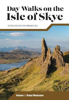
Day Walks on the Isle of Skye
Vertebrate Publishing Ltd (Verlag)
978-1-83981-151-7 (ISBN)
Day Walks on the Isle of Skye features 20 routes between 3.4 and 14.5 miles (5.5km and 23.3km) in length, spread across the Isle of Skye with one walk on the neighbouring Isle of Raasay. Researched and written by experienced and knowledgeable authors Helen and Paul Webster, founders of the Walkhighlands website, the walks explore the rugged mountains and wildlife-rich
coastline of the islands.
The routes are split into four sections – Trotternish and the Braes; North-West Skye; Glen Brittle and Sligachan; and South Skye and the Isle of Raasay.
Together with stunning photography, each route features Ordnance Survey 1:25,000 maps, easy-to-follow directions, details of distance and navigation information, and refreshment stops and local information.
Helen and Paul Webster share a passion for walking and wild places. In 2003–2004 they undertook a life-changing 4,000-mile continuous backpacking trip across Europe. Following their return, they quit their careers to begin a new life evangelising for Scotland’s spectacular outdoors – especially the Highlands and Islands. Together they set up Walkhighlands, a free online guide and forum which has become the busiest walkers’ website in the UK. They have also written nineteen guidebooks to various areas of Scotland, including Scottish Island Bagging, and in 2018 Paul won the Scottish Landscape Photographer of the Year competition. They live in the Cairngorms National Park.
Isle of Skye Area Map & Route Finder
Introduction
About the walks
Navigation
GPS & mobile phones
Safety
Bothies
Roads & parking
Scottish Outdoor Access Code
How to use this book
Maps, descriptions, distances
Km/mile conversion chart
Scottish place names
Section 1 – Trotternish & the Braes
1 Ben Tianavaig
2 Rubha Hunish
3 Quiraing
4 The Storr & its Old Man
Section 2 – North-West Skye
5 The Hoe & Waterstein Head
6 Ramasaig to Orbost via MacLeod’s Maidens
Section 3 – Glen Brittle & Sligachan
7 Rubha an Dùnain
8 Bealach Brittle Loop
9 Marsco
10 Sgùrr na Strì
11 Glamaig & the Red Cuillin
12 Bruach na Frìthe
13 Sgùrr na Banachdaich
14 Sgùrr Dearg & the Inaccessible Pinnacle
Section 4 – South Skye & the Isle of Raasay
15 Point of Sleat
16 Boreraig & Suisnish
17 Dùn Caan, Isle of Raasay
18 Elgol & Camasunary Circuit
19 Broadford Red Hills
20 Blàbheinn
Appendix
| Erscheinungsdatum | 09.03.2022 |
|---|---|
| Reihe/Serie | Day Walks |
| Zusatzinfo | Ordnance Survey 1:25,000; Colour photographs |
| Sprache | englisch |
| Maße | 120 x 175 mm |
| Gewicht | 250 g |
| Themenwelt | Sachbuch/Ratgeber ► Natur / Technik ► Natur / Ökologie |
| Sachbuch/Ratgeber ► Sport | |
| Reiseführer ► Europa ► Großbritannien | |
| ISBN-10 | 1-83981-151-X / 183981151X |
| ISBN-13 | 978-1-83981-151-7 / 9781839811517 |
| Zustand | Neuware |
| Haben Sie eine Frage zum Produkt? |
aus dem Bereich


