


Road Map North of England & Scottish Borders
Seiten
2022
|
New edition
Automobile Association (Verlag)
978-0-7495-8287-6 (ISBN)
Automobile Association (Verlag)
978-0-7495-8287-6 (ISBN)
- Titel ist leider vergriffen;
keine Neuauflage - Artikel merken
Zu diesem Artikel existiert eine Nachauflage
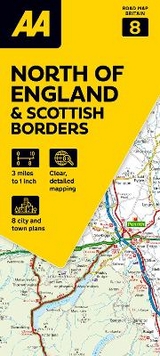
Britain’s clearest mapping from the experts at the AA, in a handy foldable map. Fully updated, the map combines clear design and an easy-to-read scale with more road detail to ensure that you never lose your way.
Each map includes information on toll points, service areas, road numbers, motorways, dual carriageways and wide and narrow local roads. National Parks and places of interest are also highlighted. Practical, slimline format with durable, plastic encapsulated covers. Clear mapping at an easy-to-read scale. National Trust, English Heritage, Scottish and Welsh Heritage sites all shown.
Each map includes information on toll points, service areas, road numbers, motorways, dual carriageways and wide and narrow local roads. National Parks and places of interest are also highlighted. Practical, slimline format with durable, plastic encapsulated covers. Clear mapping at an easy-to-read scale. National Trust, English Heritage, Scottish and Welsh Heritage sites all shown.
| Erscheint lt. Verlag | 3.3.2022 |
|---|---|
| Reihe/Serie | Road Map Britain ; 8 |
| Verlagsort | Basingstoke |
| Sprache | englisch |
| Maße | 118 x 252 mm |
| Themenwelt | Reisen ► Karten / Stadtpläne / Atlanten ► Europa |
| ISBN-10 | 0-7495-8287-1 / 0749582871 |
| ISBN-13 | 978-0-7495-8287-6 / 9780749582876 |
| Zustand | Neuware |
| Haben Sie eine Frage zum Produkt? |
Mehr entdecken
aus dem Bereich


aus dem Bereich
Straßen- und Freizeitkarte 1:250.000
Karte (gefalzt) (2023)
Freytag-Berndt und ARTARIA (Verlag)
12,90 €
Karte (gefalzt) (2023)
Freytag-Berndt und ARTARIA (Verlag)
12,90 €
Narvik
Karte (gefalzt) (2023)
Freytag-Berndt und ARTARIA (Verlag)
12,90 €