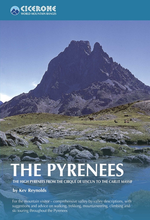
The Pyrenees
Cicerone Press (Verlag)
978-1-85284-420-2 (ISBN)
A resource book covering the finest walks, treks and climbs in the High Pyrenees for 400km between France and Spain, from the Cirque de Lescun, on the edge of the Basque country in the west, to the Carlit massif and the Cerdagne to the east of Andorra. The book is divided into five regional chapters: the Western Valleys; Cirques and Canyons; the Central Pyrenees; Enchanted Mountains; and Andorra and the Eastern High Pyrenees. Intended as a resource book for those planning a range of mountain activities in the Pyrenees, the guide describes each area valley by valley, and provides information on access and accommodation, as well as recommended maps and guidebooks. Unlike a conventional walking book, detailed route descriptions are not included; the guide does, however, direct the reader to the finest walks, treks and climbs in the area and provide an outline of specially selected routes. An extensive introduction gives all the practical advice and information needed for planning a trip. It offers a background to the mountains and their exploration, and provides a snapshot of the range with sections that help the reader focus on specific areas of activity, and suggests where best to exercise that activity.
Kev Reynolds is a freelance writer, photojournalist and lecturer. He has published many books on the Alps, a series of trekkers' guides to Nepal and, nearer to home, several guides on walking in southern England. A member of the Alpine Club, Austrian Alpine Club and the Outdoor Writers' Guild, he is also first Honorary Member of the British Association of European Mountain Leaders.
CHAPTER 1: The Western Valleys
1:1 Vall&##xe9;e d'Aspe
1:2 The Cirque de Lescun
1:3 Upper Vall&##xe9;e d'Aspe
1:4 Valle del Aragón (Valle de Canfranc)
1:5 Valle de Echo
1:6 Valle de Ansó
1:7 Vall&##xe9;e d'Ossau
1:8 Vall&##xe9;e du Valentin
1:9 The Upper Vall&##xe9;e d'Ossau
1:10 Valle de Tena
Access, Bases, Maps and Guides
CHAPTER 2: Cirques and Canyons
2:1 Vall&##xe9;e du Gave de Pau
2:2 Vall&##xe9;e d'Estaing
2:3 Vall&##xe9;e d'Arrens
2:4 Vall&##xe9;e de Cauterets
2:5 Vall&##xe9;e du Marcadau
2:6 Vall&##xe9;e de Gaube
2:7 Vall&##xe9;e de Lutour
2:8 Vall&##xe9;e de Bastan
2:9 In and around the N&##xe9;ouvielle reserve
2:10 Vall&##xe9;e de H&##xe9;as
2:11 Cirque de Gavarnie
2:12 Valle del Ara
2:13 Valle de Ordesa
2:14 Valle de Añisclo
2:15 Valle de Tella
2:16 Valle de Pineta
2:17 Valle de Barrosa
Access, Bases, Maps and Guides
CHAPTER 3: The Central Pyrenees
3:1 Vall&##xe9;e d'Aure
3:2 Vall&##xe9;e du Louron
3:3 Vall&##xe9;e d'Oô
3:4 Vall&##xe9;e de la Pique
3:5 Valle de Gistaín
3:6 Valle del Ésera
3:7 Valle de Eriste
3:8 Valle de Estós
3:9 Vallhiverna
3:10 Upper Ésera
Access, Bases, Maps and Guides
CHAPTER 4: Enchanted Mountains
4:1 Pays de Couserans
4:2 Vall&##xe9;e du Biros
4:3 Vall&##xe9;e de Bethmale
4:4 Upper Vall&##xe9;e du Salat
4:5 Vall&##xe9;e d'Ustou
4:6 Vall&##xe9;e du Garbet
4:7 Vall d'Aran
4:8 Vall Noguera Ribagorçana
4:9 Vall de Boí
4:10 Vall Fosca
4:11 Vall d'Espot
4:12 Vall d'Àneu
4:13 Vall de Cardós
4:14 Vall Ferrera
Access, Bases, Maps and Guides
CHAPTER 5: Andorra and the Eastern High Pyrenees
5:1 Vall&##xe9;e du Vicdessos
5:2 Haute Vall&##xe9;e de l'Ari&##xe8;ge
5:3 Andorra
5:4 Vall&##xe9;e d'Orlu
5:5 The Carlit Massif
5:6 The Cerdagne
5:7 Vall de Núria
Access, Bases, Maps and Guides
| Erscheint lt. Verlag | 20.10.2010 |
|---|---|
| Reihe/Serie | Cicerone guidebooks |
| Zusatzinfo | Over 150 colour photos and 30 maps |
| Verlagsort | Kendal |
| Sprache | englisch |
| Maße | 138 x 216 mm |
| Gewicht | 840 g |
| Themenwelt | Sachbuch/Ratgeber ► Sport |
| Reiseführer ► Europa ► Frankreich | |
| Reiseführer ► Europa ► Spanien | |
| Reisen ► Sport- / Aktivreisen ► Europa | |
| ISBN-10 | 1-85284-420-5 / 1852844205 |
| ISBN-13 | 978-1-85284-420-2 / 9781852844202 |
| Zustand | Neuware |
| Informationen gemäß Produktsicherheitsverordnung (GPSR) | |
| Haben Sie eine Frage zum Produkt? |
aus dem Bereich


