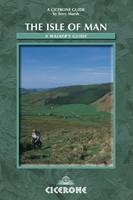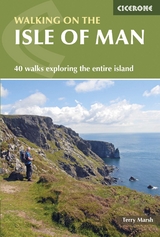
The Isle of Man
Cicerone Press (Verlag)
978-1-85284-399-1 (ISBN)
- Titel erscheint in neuer Auflage
- Artikel merken
The scope for walking on the Isle of Man is considerable. Being an island, and a smallish one at that, many walks touch upon the coastline at some point, and it is probably true to say that on every walk in this book you can see the sea at some stage, ensuring that each of the walks has its own very distinctive flavour. The guide includes: 40 walks around the Isle of Man; an introduction to the Isle of Man today and in the past, the island's flora and fauna, and to walking on the island; information about getting to and around the island; an appendix including longer waymarked walks, useful addresses and organisations; a bibliography and a glossary of Manx place names and terms.
Terry Marsh specialises in the outdoors, the countryside, walking and travel worldwide. He is author of 40+ books including the award-winning Cicerone guides to the Northern Coast to Coast Walk (1994 and 2003) and the Shropshire Way (1999), and guides to the Pennine Way, the Dales Way, the Severn Way and the West Highland Way.
The Walks
The North
1: Ayres, Point of Ayre and Bride
2: Maughold, Port Mooar and Port e Vullen
3: Cornaa, Glen Mona and Ballaglass Glen
4: Clagh Ouyr and North Barrule
5: Snaefell from the Bungalow
6: Laxey, Agneash and King Orry's Grave
7: The Snaefell Mines
8: Sulby and the Millennium Way
9: Slieu Curn and Slieu Dhoo
10: Kirk Michael and Slieau Freoghane
11: Slieau Freoghane from the mountain road
12: Glen Mooar
13: Orrisdale and Glen Trunk
14: A taste of the Millennium Way
15: Glen Wyllin
16: Sulby Reservoir
The South
17: Peel Hill and Corrins Hill
18: Glen Maye, the coast path and Patrick
19: Port Erin to Peel
20: Cregneash and Mull Hill
21: Glen Maye, Niarbyl Bay and Dalby Mountain
22: Corlea and South Barrule
23: Glen Maye to Glen Rushen by Dalby Mountain
24: Cronk ny Arrey Laa
25: Lhiattee ny Beinnee and Fleshwick Bay
26: Bradda Hill
27: Port St Mary and Port Erin
28: Colby Glen, Ballakilpheric and Bay ny Carrickey
29: Castletown and Scarlett Point
30: Silverdale Glen and Ballasalla
31: Groudle Glen and Baldrine
32: Baldwin, Union Mills and Crosby
33: Slieau Ruy and Greeba Mountain
34: Port Grenaugh, Port Soldrick and Cass ny Hawin
35: Port Grenaugh, Pistol Bay and Santon Head
36: St John's, Slieau Whallian, Patrick and the Heritage Trail
37: Glen Maye and the Postman's Path
38: Derbyhaven, St Michael's Island and Langness
39: Mull Hill, Spanish Head and The Chasms
40: South Barrule
| Erscheint lt. Verlag | 30.4.2010 |
|---|---|
| Zusatzinfo | 60 colour photos and 40 OS maps |
| Verlagsort | Kendal |
| Sprache | englisch |
| Maße | 116 x 172 mm |
| Gewicht | 200 g |
| Themenwelt | Sachbuch/Ratgeber ► Sport |
| Reiseführer ► Europa ► Großbritannien | |
| ISBN-10 | 1-85284-399-3 / 1852843993 |
| ISBN-13 | 978-1-85284-399-1 / 9781852843991 |
| Zustand | Neuware |
| Haben Sie eine Frage zum Produkt? |
aus dem Bereich


