Alta Via 1 - Trekking in the Dolomites
Cicerone Press (Verlag)
978-1-78631-081-1 (ISBN)
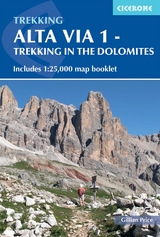
A guidebook containing all the information you need to walk the Alta Via 1 between Lago di Braies and La Pissa. Covering 115km (72 miles), this hut-to-hut long-distance hiking trail through the heart of the Dolomites in northeastern Italy takes about 2 weeks and is suitable for both first-time and experienced trekkers.
The route is described from north to south in 11 stages, each between 6 and 14km (4–9 miles) in length. Easier path variants, exit routes to reach public transport and side routes to explore nearby summits and points of interest are detailed. Advice on 4- or 5-day sections of the route for walkers who prefer not to walk AV1 in its entirety is also given.
Includes a separate map booklet containing 1:25,000 Kompass mapping
1:75,000 maps included in the main book for each stage
GPX files available to download
Detailed information about mountain huts and facilities along the route
Advice on planning and preparation
Gillian Price has trekked throughout Asia and the Himalaya but now lives in Venice. Gillian has steadily explored the mountain ranges of Italy, and Corsica, and brought them to life for visitors in a series of outstanding guides for Cicerone. She is an active member of the Italian Alpine Club (CAI) and Mountain Wilderness.
Map key
Overview map
Route summary table
Preface to this edition
Introduction
The Dolomites
The route
Geology
Plants and flowers
Wildlife
How to get there
When to go
Shorter itineraries
Accommodation
Food and drink
What to take
Maps
Languages and place names
Dos and don'ts
Emergencies
Using this guide
Alta Via 1
Stage 1 Lago di Braies to Rifugio Biella
Stage 2 Rifugio Biella to Rifugio Fanes
Stage 3 Rifugio Fanes to Rifugio Lagazuoi
Stage 4 Rifugio Lagazuoi to Rifugio Nuvolau
Stage 5 Rifugio Nuvolau to Rifugio Citt&##xe0; di Fiume
Stage 6 Rifugio Citt&##xe0; di Fiume to Rifugio Coldai
Stage 7 Rifugio Coldai to Rifugio Vazzoler
Stage 8 Rifugio Vazzoler to Rifugio Carestiato
Stage 9 Rifugio Carestiato to Rifugio Pramperet
Stage 10 Rifugio Pramperet to Rifugio Pian de Fontana
Stage 11 Rifugio Pian de Fontana to La Pissa bus stop
Appendix A Useful contacts
Appendix B Italian-English glossary
| Erscheinungsdatum | 28.03.2022 |
|---|---|
| Reihe/Serie | Cicerone guidebooks |
| Verlagsort | Kendal |
| Sprache | englisch |
| Maße | 116 x 172 mm |
| Gewicht | 190 g |
| Themenwelt | Sachbuch/Ratgeber ► Sport |
| Reisen ► Sport- / Aktivreisen ► Europa | |
| ISBN-10 | 1-78631-081-3 / 1786310813 |
| ISBN-13 | 978-1-78631-081-1 / 9781786310811 |
| Zustand | Neuware |
| Haben Sie eine Frage zum Produkt? |
aus dem Bereich