Walking Ben Lawers, Rannoch and Atholl
Cicerone Press (Verlag)
978-1-78631-107-8 (ISBN)
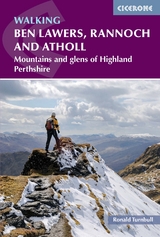
A guidebook to 80 walks in the highlands of Perthshire. Exploring the beautiful scenery of Scotland's south-eastern Grampians, the walks are suitable for most walkers, with shorter routes alongside plenty of more challenging, full-day hikes. The routes include 42 Munro ascents, 22 Corbetts, 15 smaller hills and the Gaick and Minigaig passes.
The walks range from 3 to 45km (2–28 miles) and can be enjoyed in 1–13 hours. April to August is the best walking time for all routes, with April and May the best of all. Highlights include Ben Lawers, Rannoch Moor and Schiehallion, and the routes can easily be accessed from Perth and Crianlarich. Other centres include Comrie, Crieff, Aberfeldy, Killin, Dunkeld, Pitlochry and Blair Atholl.
Either 1:50,000 OS or 1:100,000 maps are included for each route
Routes are graded by length and difficulty
Notes on local transport, accommodation and facilities
Comprehensive advice on access during the deer-stalking season
Sized to easily fit in a jacket pocket
Ronald Turnbull enjoys multi-day treks, through the Highlands in particular, and has made 21 different coast-to-coast crossings of the UK. He has also slept out, in bivvy bag rather than tent, on over 80 UK summits. He writes regularly for Lakeland Walker, TGO magazine and UKhillwalking.com and has written many other Cicerone guides, including Walking in the Lowther Hills, The Book of the Bivvy and Not the West Highland Way. He has seven times won Outdoor Writers & Photographers Guild Awards for Excellence for his guidebooks, outdoor books (including Book of the Bivvy) and magazine articles.
Map key
Introduction
Jolly green giants
Trees, please!
When to go
Safety in the mountains
Maps
Compass and GPS
Using this guide
PART 1: Comrie and Crieff
1 Meal na Fearna to Ben Vorlich
2 Beinn Dearg
3 Water of Ruchill
4 Comrie: Deil's Caldron
5 Glen Tarken tracks
6 Ben Chonzie and Auchnafree Hill
7 Crieff, its Knock, and River Earn
8 Glen Almond and the Lochan Slot
PART 2: Killin and Glen Lochay
9 Looking at Loch Tay: Meall Clachach
10 Cam Chreag and Ben Challum
11 Beinn nan Imirean, Meall Glas
12 The Tarmachans
Summit summary: Ben Lawers
13 Edramucky Burn
14 Up and down from the Lairig road
15 Lawers Four from Lawers village
16 The Cat's Bowl (descent)
17 Down via Beinn Ghlas to Lawers village (descent)
18 Glen Lyon: Da-Eig Circuit
PART 3: Glen Lyon
19 Carn Mairg from Fortingall
20 Back of Schiehallion
21 The Black Crag of Glen Lyon
22 Beinn Dearg and the Mairgs
23 Meall Ghaordaidh from Glen Lyon
24 Around Loch an Daimh
25 Beinn Heasgarnich and Creag Mhor
PART 4: Bridge of Orchy
Summit summary: Beinn Dorain
26 Beinn a' Chaisteal and Beinn nam Fuaran
27 Beinn Mhanach, the Monk
28 Dorain and Dothaidh from the back
29 Bridge of Orchy to Beinn Dorain, Beinn an Dothaidh
30 Beinn Mhanach long crossing
31 Rannoch Edge: Chreachain and Achaladair
32 Beinn an Dothaidh from Achallader
33 The Lyon side: Chreachain, Achaladair, Mhanach
PART 5: Perth and Dunkeld
34 Perth and Kinnoull Hill
35 Dunkeld, Birnam Hill and the Tay
36 Tracks to Loch Skiach
37 Craig Lochie
PART 6: Aberfeldy
38 Farragon Hill from Strathtay
39 Aberfeldy: Rob and Rabbie
40 Aberfeldy and the Tay
41 Kenmore and the Tay
42 Falls of Acharn
43 Falls of Acharn to Creag an Sgliata
44 Creagan na Beinne and Ardtalnaig
45 Creag Uchdag
PART 7: Tummel and Loch Rannoch
46 Schiehallion end to end
47 Schiehallion Foot: Limestone and McGregor's Cave
48 Craig Varr and Kinloch Rannoch
49 Beinn a' Chuallaich
50 Black Wood of Rannoch
Summit summary: Ben Alder
51 Walk in to Benalder Cottage
52 Ben Alder from Benalder Cottage
53 Benalder Cottage to Culra Bothy via Beinn Bheoil
54 Benalder Cottage to Culra Bothy via Bealach Beithe (and in reverse)
55 Walk/ride in to Culra Bothy
56 Long Leachas from Culra Bothy
57 Short Leachas from Culra Bothy
58 Ben Alder to Bealach Breabag (descent)
PART 8: Rannoch Moor
59 The Road to the Isles
60 Two Munros and Beinn Pharlagain
61 Meall Buidhe and Cam Chreag
62 Tracks to the Foxes Bog
63 Leagag
PART 9: Pitlochry and Blair Atholl
64 Pitlochry and its loch
65 Ben Vrackie and River Garry
66 Blair Castle to Glen Tilt
67 Glen Tilt and Carn a' Chlamain
68 Old Bridge of Tilt to Dearg, Mheadhonach
69 Bruar Falls and Glen Banvie
70 Bruar Falls and Blair
Summit summary: Beinn a' Ghlo
71 Around Beinn a' Ghlo (with optional ascent of Ben Vuirich)
72 Beinn a' Ghlo from Loch Moraig
73 Carn nan Gabhar north ridge to Glen Tilt (descent)
74 Glen Tilt to Braigh Coire Chruinn-bhalgain by Carn Torcaidh
PART 10: Drumochter
The Atholl Passes
75 Glen Tilt
76 Minigaig Pass to Glen Feshie
77 Minigaig Pass the ancient way
78 Gaick Pass
79 A' Bhuidheanach Bheag by the Crooked Corrie
80 Udlamains and the Sow
Appendix A Route summary table
Appendix B Access (especially in the stalking season)
Appendix C Shops, accommodation and transport
| Erscheinungsdatum | 18.08.2021 |
|---|---|
| Reihe/Serie | Cicerone guidebooks |
| Zusatzinfo | 130 colour photos and 50 maps |
| Verlagsort | Kendal |
| Sprache | englisch |
| Maße | 116 x 172 mm |
| Gewicht | 370 g |
| Themenwelt | Sachbuch/Ratgeber ► Sport |
| Reisen ► Sport- / Aktivreisen ► Europa | |
| ISBN-10 | 1-78631-107-0 / 1786311070 |
| ISBN-13 | 978-1-78631-107-8 / 9781786311078 |
| Zustand | Neuware |
| Haben Sie eine Frage zum Produkt? |
aus dem Bereich