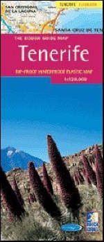
The Rough Guide Map Tenerife
2018
Rough Guides (Verlag)
978-1-84353-234-7 (ISBN)
Rough Guides (Verlag)
978-1-84353-234-7 (ISBN)
- Titel ist leider vergriffen;
keine Neuauflage - Artikel merken
Covers Tenerife island's various villages and lines of communication, from the coastal motorway to the footpaths up Mount Teide. This guide details the island's many beaches, from gentle sandy bays to rock-bound strands of crashing surf for serious surfers.
You need a good map to get the best out of the much-maligned Atlantic island of Tenerife. Most British visitors, staying in Playa de las Americas or Los Cristianos only see the arid southwest corner of the island near the airport. Quite different is the lush northern coast, with its misty valleys and banana groves, and the high, gaunt centre formed by the extinct volcano, Teide. The Rough Guide map has detailed coverage of every village and every line of communication, from the coastal motorway to the footpaths up Mount Teide. Also detailed in this title in full are all the island's many beaches, from gentle sandy bays to rock-bound strands of crashing surf for serious surfers.
You need a good map to get the best out of the much-maligned Atlantic island of Tenerife. Most British visitors, staying in Playa de las Americas or Los Cristianos only see the arid southwest corner of the island near the airport. Quite different is the lush northern coast, with its misty valleys and banana groves, and the high, gaunt centre formed by the extinct volcano, Teide. The Rough Guide map has detailed coverage of every village and every line of communication, from the coastal motorway to the footpaths up Mount Teide. Also detailed in this title in full are all the island's many beaches, from gentle sandy bays to rock-bound strands of crashing surf for serious surfers.
Produced in association with The World Mapping Project.
| Erscheint lt. Verlag | 14.4.2018 |
|---|---|
| Reihe/Serie | The Rough Guide Map |
| Zusatzinfo | colour, plastic |
| Verlagsort | London |
| Sprache | englisch |
| Maße | 103 x 247 mm |
| Gewicht | 60 g |
| Themenwelt | Reisen ► Karten / Stadtpläne / Atlanten ► Europa |
| Reisen ► Karten / Stadtpläne / Atlanten ► Welt / Arktis / Antarktis | |
| ISBN-10 | 1-84353-234-4 / 1843532344 |
| ISBN-13 | 978-1-84353-234-7 / 9781843532347 |
| Zustand | Neuware |
| Haben Sie eine Frage zum Produkt? |
Mehr entdecken
aus dem Bereich
aus dem Bereich
Straßen- und Freizeitkarte 1:250.000
Karte (gefalzt) (2023)
Freytag-Berndt und ARTARIA (Verlag)
12,90 €
Karte (gefalzt) (2023)
Freytag-Berndt und ARTARIA (Verlag)
12,90 €
Östersund
Karte (gefalzt) (2023)
Freytag-Berndt und ARTARIA (Verlag)
12,90 €


