


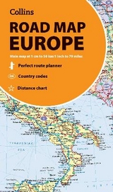
Collins Map of Europe
Seiten
2022
Collins (Verlag)
978-0-00-840397-3 (ISBN)
Collins (Verlag)
978-0-00-840397-3 (ISBN)
- Titel erscheint in neuer Auflage
- Artikel merken
Zu diesem Artikel existiert eine Nachauflage
Discover new places with handy maps from Collins.
A fully revised and updated colour road map of Europe at a scale of 79 miles to 1 inch / 50km to 1cm (1: 5,000,000). Roads, motorways, European Route numbers, railways, airports, cities and towns are clearly shown, making the map ideal for route-finding and planning journeys.
Main features
Fully revised and updated
Full index to place names (on reverse of sheet)
Distance chart giving distances in kilometres between main towns
European Union map showing member states and the Eurozone
Internet links to further information on Europe
Area of coverage
Covers the whole of Europe from the North Cape (Norway) to Gibraltar and from Ireland to east of Moscow. Also includes Iceland and Cyprus.
Key to approved country code abbreviations – GB, F, D etc.
Map key in English, French, German, Spanish and Italian
Explore the world through accurate and up-to-date mapping.
| Erscheint lt. Verlag | 17.3.2022 |
|---|---|
| Verlagsort | London |
| Sprache | englisch |
| Maße | 140 x 250 mm |
| Gewicht | 80 g |
| Themenwelt | Reisen ► Karten / Stadtpläne / Atlanten ► Europa |
| Reisen ► Karten / Stadtpläne / Atlanten ► Welt / Arktis / Antarktis | |
| ISBN-10 | 0-00-840397-X / 000840397X |
| ISBN-13 | 978-0-00-840397-3 / 9780008403973 |
| Zustand | Neuware |
| Haben Sie eine Frage zum Produkt? |
Mehr entdecken
aus dem Bereich


aus dem Bereich
Straßen- und Freizeitkarte 1:250.000
Karte (gefalzt) (2023)
Freytag-Berndt und ARTARIA (Verlag)
12,90 €
Karte (gefalzt) (2023)
Freytag-Berndt und ARTARIA (Verlag)
12,90 €
Östersund
Karte (gefalzt) (2023)
Freytag-Berndt und ARTARIA (Verlag)
12,90 €