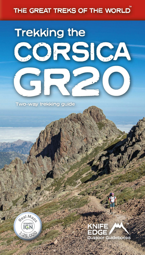
Trekking the Corsica GR20 - Two-Way Trekking Guide - Real IGN Maps 1:25,000
Seiten
2020
Knife Edge Outdoor Limited (Verlag)
978-1-912933-05-1 (ISBN)
Knife Edge Outdoor Limited (Verlag)
978-1-912933-05-1 (ISBN)
- Titel erscheint in neuer Auflage
- Artikel merken
Zu diesem Artikel existiert eine Nachauflage
The only two-way guidebook to the GR20: both northbound and southbound routes are described in full. Real IGN Maps included (1:25,000): no need to carry separate maps.
The definitive guidebook to the Corsica GR20, one of the world's great treks. -The only two-way guidebook to the GR20: both northbound and southbound routes are described in full. - Real IGN Maps included (1:25,000): no need to carry separate maps. -15 different itineraries: schedules of 9, 10, 11, 12, 13, 14, 15 and 16 days. Includes both northbound and southbound itineraries. Difficult calculations of time, distance and altitude gain are done for you. Also includes: - Detailed information on equipment and travelling light -Detailed information on getting to/from all trail-heads - Everything the trekker needs to know: route, costs, difficulty, weather, travel, and more -Full accommodation listings: spectacularly situated mountain huts and campsites - Information for both self-guided and guided trekkers - Numbered waypoints linking the Real IGN Maps to our clear descriptions -Information on Wildlife and Plants
The definitive guidebook to the Corsica GR20, one of the world's great treks. -The only two-way guidebook to the GR20: both northbound and southbound routes are described in full. - Real IGN Maps included (1:25,000): no need to carry separate maps. -15 different itineraries: schedules of 9, 10, 11, 12, 13, 14, 15 and 16 days. Includes both northbound and southbound itineraries. Difficult calculations of time, distance and altitude gain are done for you. Also includes: - Detailed information on equipment and travelling light -Detailed information on getting to/from all trail-heads - Everything the trekker needs to know: route, costs, difficulty, weather, travel, and more -Full accommodation listings: spectacularly situated mountain huts and campsites - Information for both self-guided and guided trekkers - Numbered waypoints linking the Real IGN Maps to our clear descriptions -Information on Wildlife and Plants
Andrew McCluggage is an outdoor writer/photographer. He is from Ireland and has been a keen mountain walker all his life. He has been trekking in the Alps for over two decades. He lives for part of the year in the French Alps and his first book was Walking in the Brianconnais, France. Since then, he has written are variety of guidebooks including Tour du Mont Blanc, Walker's Haute Route: Chamonix to Zermatt, Dolomites AV1 and Walking Brittany. He was a corporate lawyer for 20 years and was a partner at an international law firm.
| Erscheinungsdatum | 15.01.2021 |
|---|---|
| Reihe/Serie | Knife Edge guidebooks |
| Sprache | englisch |
| Maße | 121 x 210 mm |
| Gewicht | 268 g |
| Themenwelt | Sachbuch/Ratgeber ► Sport |
| Reisen ► Sport- / Aktivreisen ► Europa | |
| ISBN-10 | 1-912933-05-5 / 1912933055 |
| ISBN-13 | 978-1-912933-05-1 / 9781912933051 |
| Zustand | Neuware |
| Informationen gemäß Produktsicherheitsverordnung (GPSR) | |
| Haben Sie eine Frage zum Produkt? |
Mehr entdecken
aus dem Bereich
aus dem Bereich
die schönsten Küsten- und Bergwanderungen : 41 Touren mit GPS-Tracks
Buch | Softcover (2024)
Rother Bergverlag
16,90 €


