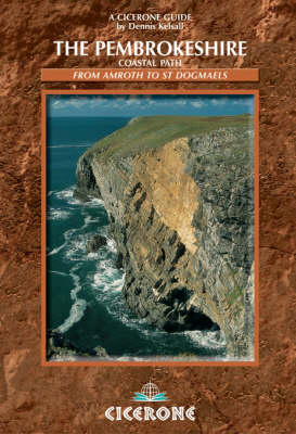
The Pembrokeshire Coastal Path
Cicerone Press (Verlag)
978-1-85284-378-6 (ISBN)
- Titel ist leider vergriffen;
keine Neuauflage - Artikel merken
The Pembrokeshire Coastal Path National Trail is a 182 mile walk from Amroth, near Tenby to St Dogmaels, north of Newport. The walk in this guidebook is divided into 15 clear sections of between 7 and 19 miles. There is immense variety in both the scenery and natural life of the Pembrokeshire coast and its exploration can be equally satisfying for serious walkers and those more inclined to potter. This guide is designed to assist in the planning of a long-distance walk as well as to provide a companion to point out some of the interesting features along the way. The contorted nature of the coast creates many sections that can conveniently be walked on a day basis, and a separate chapter suggests some possibilities. An accommodation guide, distance charts, and access and transport points provide additional information, together with an informative introduction which includes the region's geology, history, flora and fauna, topography and weather conditions. Short lengths of the way pass through towns and villages, but the majority is along open coast, where you may hardly meet another person all day.
Dennis and Jan Kelsall are professional outdoor writers and photographers, contributing to various magazines and producing a weekly walking feature for the Lancashire Evening Post. They have a keen interest in the environment, its geology, flora and wildlife.
THE ROUTE
1 Amroth to Tenby
7.1 miles (11.4km)
2 Tenby to Stackpole Quay
15.1 miles (24.3km)
3 Stackpole Quay to Freshwater West
14.7 miles (23.7km)
4 Freshwater West to Pembroke
18.6 miles (29.9km)
5 Pembroke to Milford Haven
11.4 miles (18.3km)
6 Milford Haven to Dale
10.7 miles (17.2km)
7 Dale to St Brides Haven
15.4 miles (24.8km)
8 St Brides Haven to Newgale Sands
12.8 miles (20.6km)
9 Newgale Sands to St Non's
9.6 miles (15.4km)
10 St Non's to Whitesands Bay
7.8 miles (12.6km)
11 Whitesands Bay to Aber Draw
11.3 miles (18.2km)
12 Aber Draw to Pwll Deri
9.7 miles (15.6km)
13 Pwll Deri to Goodwick
10.4 miles (16.7km)
14 Goodwick to Newport
11.5 miles (18.5km)
15 Newport to St Dogmaels
16.1 miles (25.9km)
| Erscheint lt. Verlag | 20.7.2012 |
|---|---|
| Verlagsort | Kendal |
| Sprache | englisch |
| Maße | 116 x 172 mm |
| Gewicht | 330 g |
| Themenwelt | Sachbuch/Ratgeber ► Sport |
| Reiseführer ► Europa ► Großbritannien | |
| ISBN-10 | 1-85284-378-0 / 1852843780 |
| ISBN-13 | 978-1-85284-378-6 / 9781852843786 |
| Zustand | Neuware |
| Informationen gemäß Produktsicherheitsverordnung (GPSR) | |
| Haben Sie eine Frage zum Produkt? |
aus dem Bereich


